With Andrew, Ben, and Anthony
This trip takes place on the traditional territory of the Homalco First Nation, who have stewarded the land and watersheds of Bute Inlet for millenia. The glaciers of the Homathko Icefield are intricately linked to the temperature rainforest, the supply of freshwater to the coast, and the health of species like oolichan and salmon. These icefields are quickly melting.
Peaks Summitted
Andrew (13): Sundial, Mist, Pembroke, Cloister, Walsingham, Howard, Timepiece, Tipping Point, Pelorus, Pelorus False (Polaris), Traverse Bump, Plateau, Grenville
Ben (12): Sundial, Pembroke, Cloister, Walsingham, Howard, Timepiece, Tipping Point, Pelorus, Pelorus False (Polaris), Traverse Bump, Plateau, Grenville
Anthony (11): Sundial, St Johns, Cloister, Walsingham, Howard, Timepiece, Pelorus, Pelorus False (Polaris), Traverse Bump, Plateau, Grenville
Prelude
In 2021 Andrew, Ben, Dan, and I completed a very successful traverse of the ridge system to the south of Toba Inlet. Since then we have been planning another trip into the mountains, with Andrew taking the lead on planning this one. For the past couple years, he has been planning a heli-in/out trip to the Homathko Icefield – less defined in objective and more exploratory in nature. He has a large topo on his wall with different zones laid out and different objectives in each zone. We tried to get our other partner Dan for the trip, but he was all tied up with other things, so it would just be the three of us.
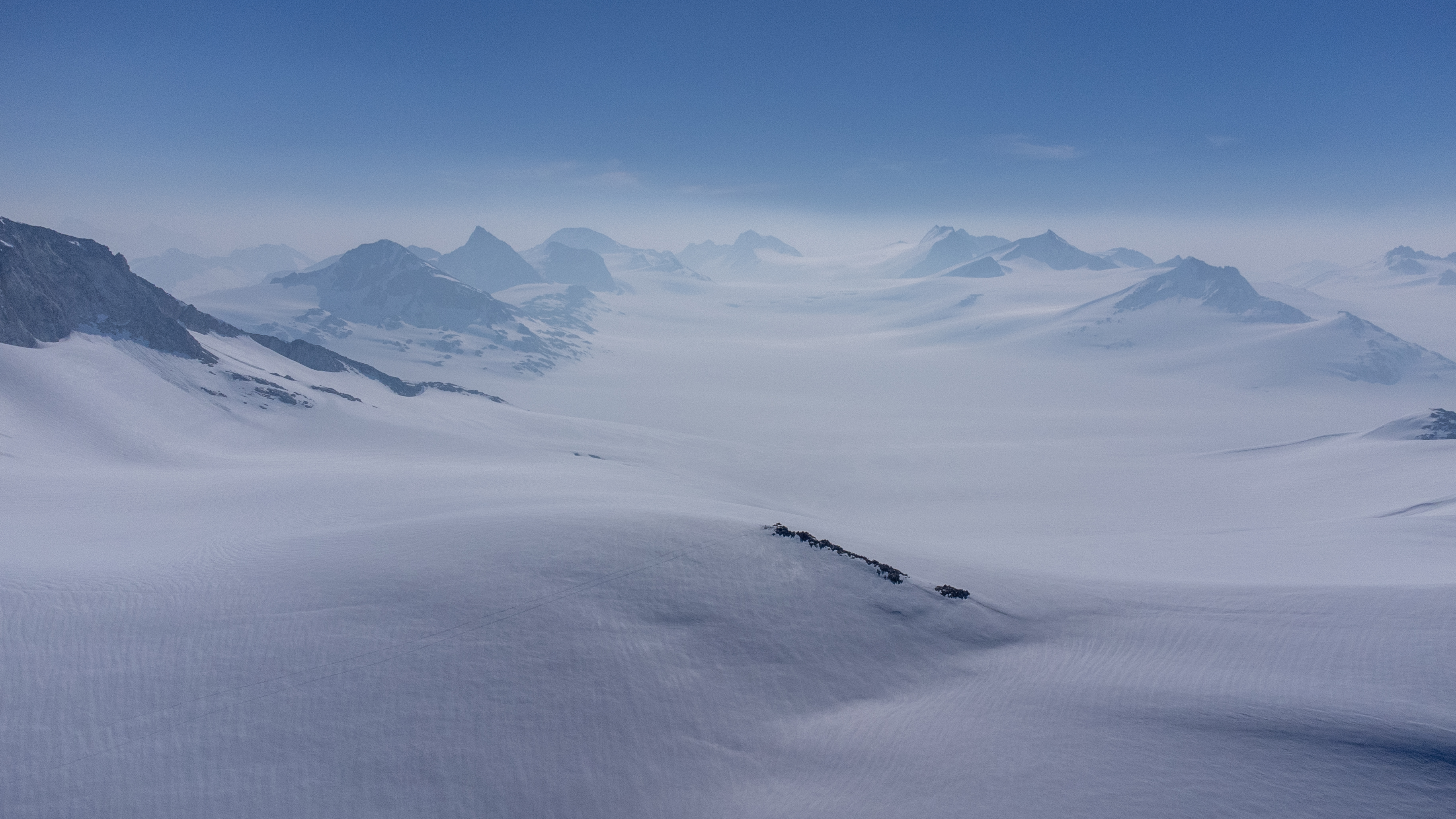
The Homathko is a large, remote icefield deep in the heart of the Coast Mountains. It drains the Homathko and Southgate Rivers into Bute Inlet and is a major source of freshwater on the BC Coast. The highest point on the icefield is Mount Grenville at 3,126m, which was one of our main objectives of the trip. The rest of the icefield is relatively low peaks with large areas of unnamed and unclimbed peaks. Ascents are becoming more challenging as the ice recedes and we ended up scrambling a lot more than initially anticipated.
As I tried to build my fitness for the trip I injured my knee and was waylaid for a month – it certainly didn’t help my fitness. Fortunately I was able to mostly rehab it and decided to stick to the trip. I was a bundle of nerves as I packed to leave my new house for 6 months – 2 weeks on the Homathko, 3 weeks guiding on the Central Coast, 2 months in the Arctic, and then 2 months guiding in the Fall – it was all a bit much and caused a great deal of stress. I also wouldn’t see my wonderful wife for nearly 40 days, which is too many days. Although I have skied nearly 200 days since, this would also be my first overnight trip on skis since 2019 when I triggered a large avalanche and broke 10 ribs and my sternum. I think this was stressing me more than I realized.
Just days before we were set to leave with an amazing forecast, Whitesaddle Air informed us there were no more helicopters available as the early fire season had diverted some of their resources. Andrew and Ben scrambled to find another heli and we were able to leave out of Campbell river with WCH just a day later than planned. On Friday night, we boarded the slowest ferry in existence – whales and traffic slowed it down – and arrived in Campbell River after midnight. We collapsed in our room at the Ramada, looking forward to our flight out the following day.

Day One: May 13, 2023
Sasquatch Camp – Sundial Day Trip
15km 1000m, 7 hours
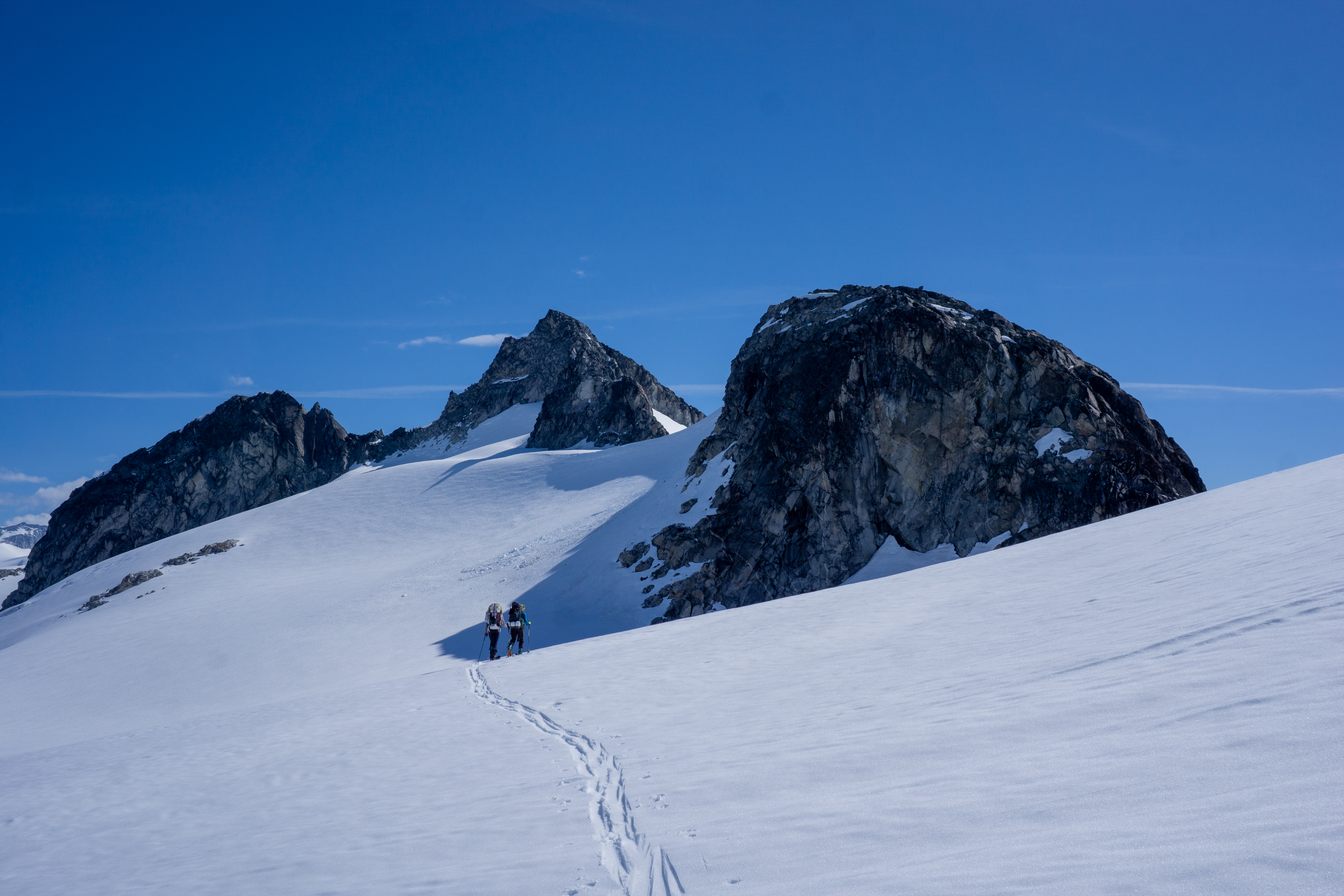
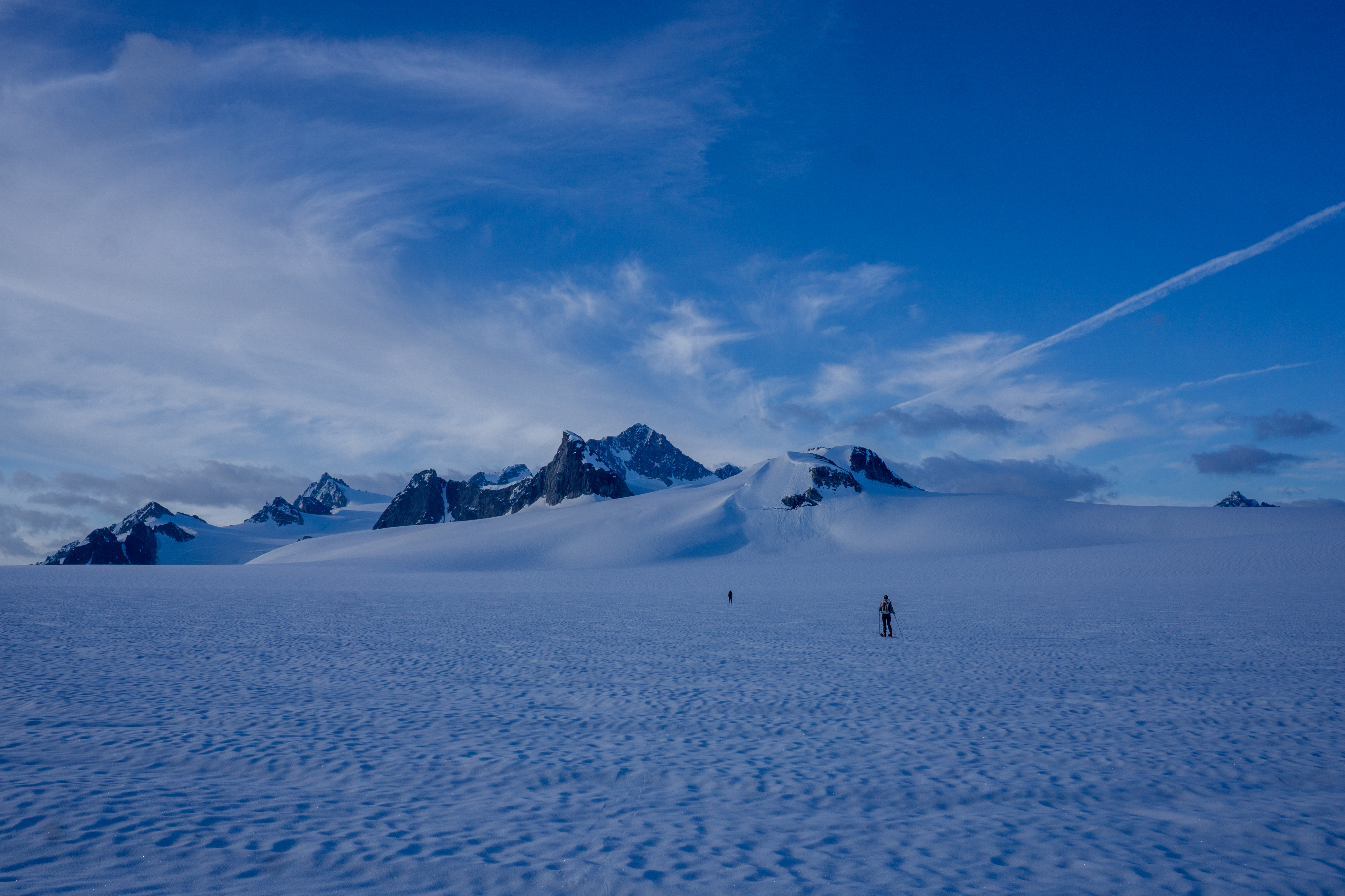
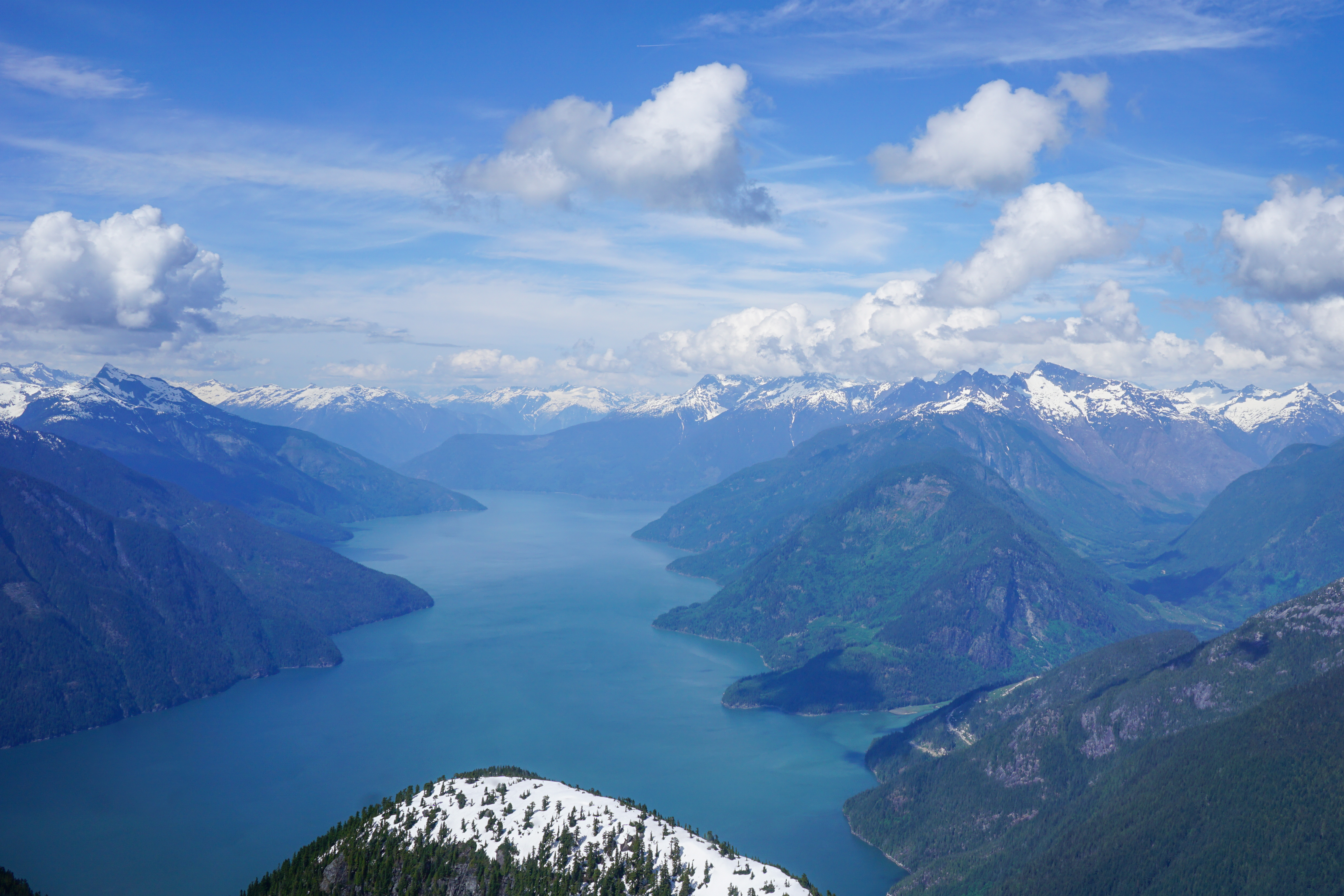
In the morning we met Tyler at 930 at the heliport in Campbell River. We reviewed the plan, signed some paperwork, and we were airborne by 1030. The flight in was gorgeous and the skies were clear. We travelled over the Discovery Islands and up Bute Inlet – waters I am familiar with having lived and guided here for nearly three years. We flew past the massive faces of Mount Bute and could see the entire icefield stretched out before us. Our food cache was made just SE of Pelorus Peak near some nice camping rocks.

Tyler dropped us off at Sasquatch Pass around 1130. Within seconds, we were alone with the silence of the icefield. Even at this hour, the sun and the heat were oppressive. We dumped our gear a short distance from where we landed and decided to head out to climb some peaks.

Trying to familiarize ourselves with the area, we thought we would walk towards the distant Howard Peak. An hour into our skin, we realized what we were in fact aiming for was Sundial Peak – about 3km further than Howard. Despite not being that close to our first camp, we were already almost there and we decided to head for the summit.


It was an annoying skin to reach the summit – involving crossing two significant bowls, but the ski down the NW face was the best of the trip. The skin back to camp was slow, but at least the sun was getting lower by the time we arrived and we could sit around without getting too hot.
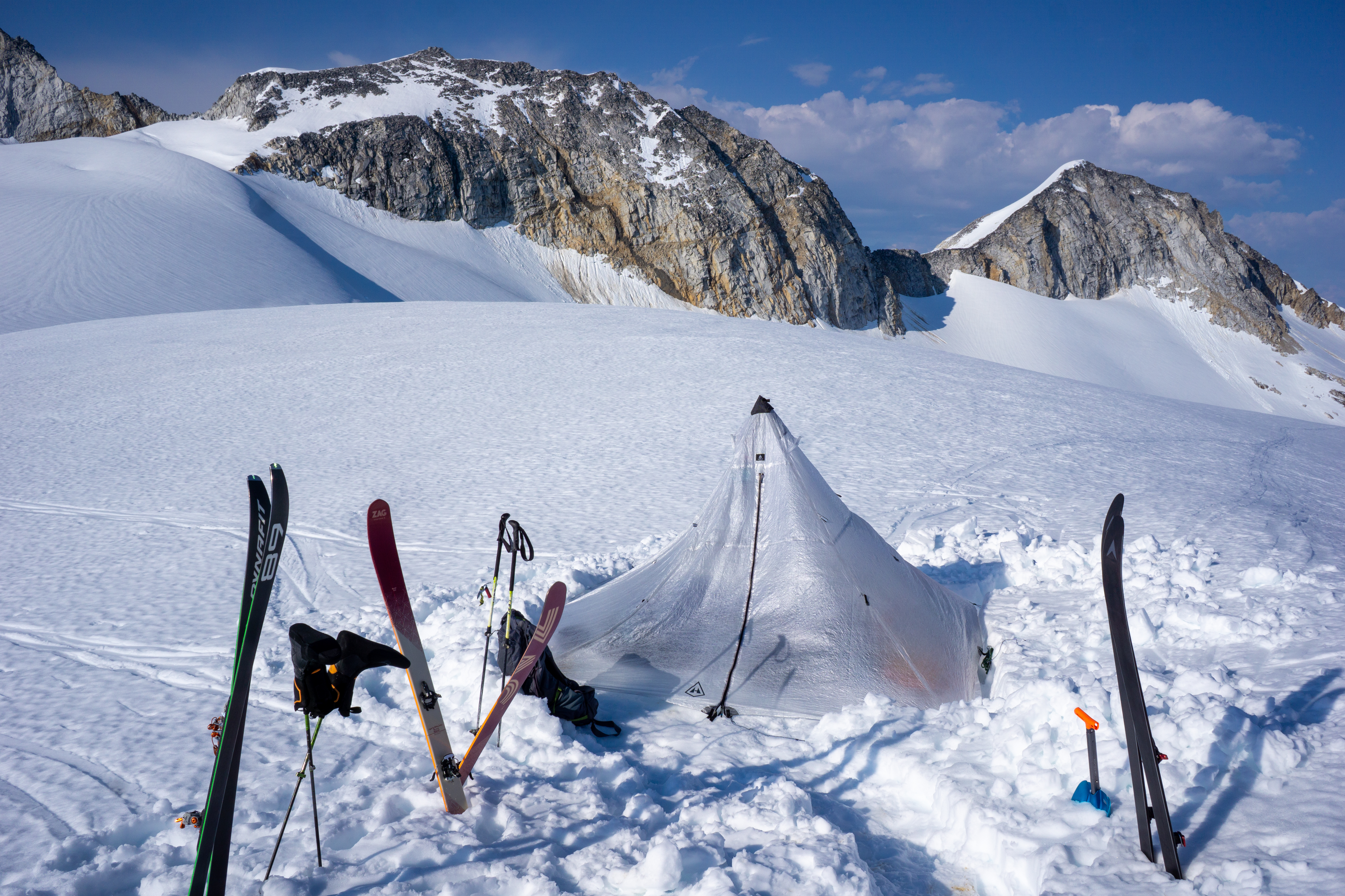
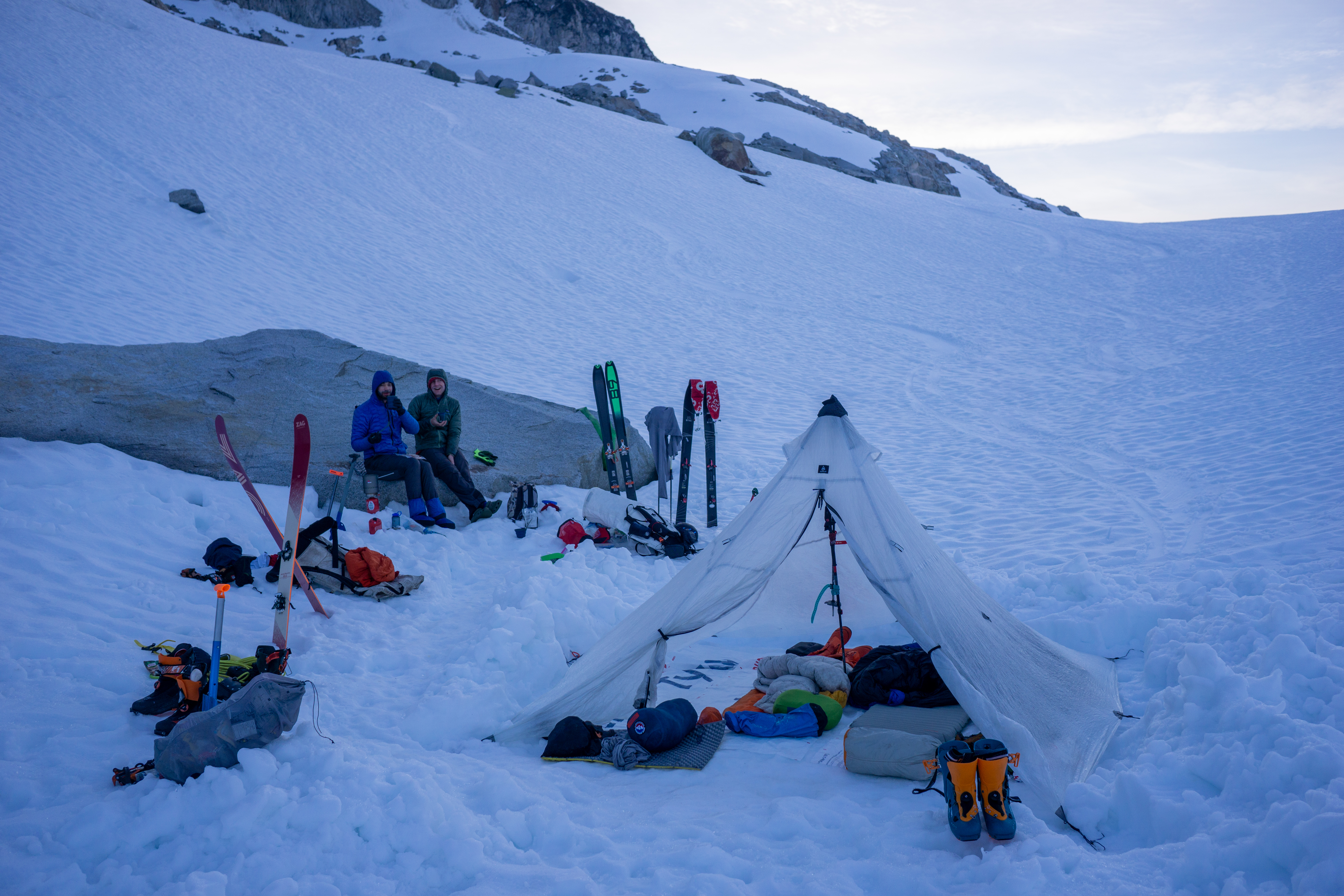
For the first time, we pitched our four-man HMG tent that Dan had loaned us for the trip. It was incredibly light and the perfect fit for three people and gear.

Day Two: May 14, 2023
Sasquatch Camp – Mist, St. John, Pembroke
13 km, 800m, 7 hours
The sun is relentless and wakes us up before six. None of us has had the best sleep. We slide around a bit on our Tyvek ground-sheets and they are crinkly and loud. Nice and lightweight though! We make a nice warm breakfast and hang out on our rock – which is slanted just steep enough to be uncomfortable. We decide to head out and ski Mist Peak before the snow softens up too much.
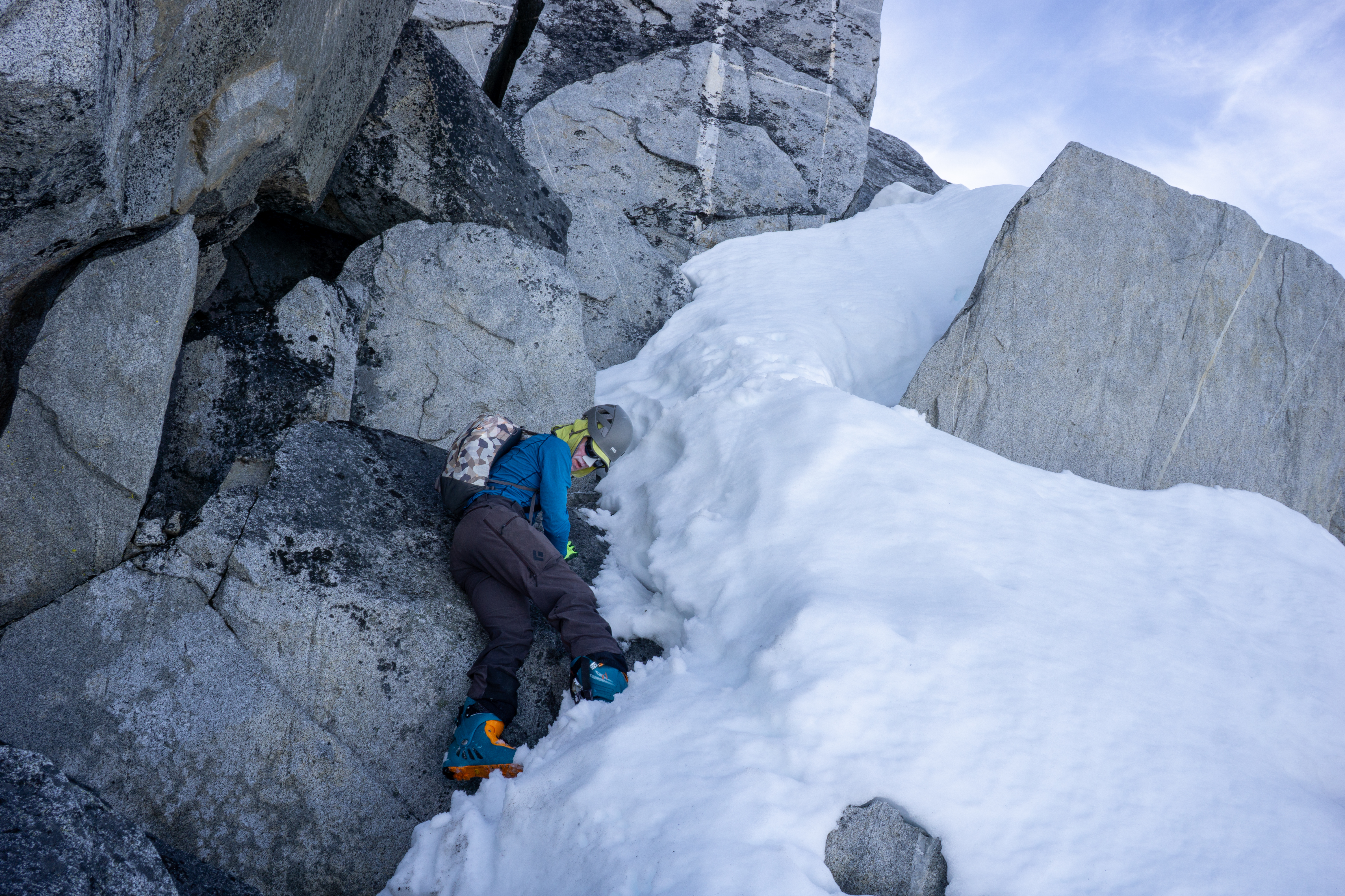
The peak is easy to skin up to about 15 m below the summit, but then we are met with a challenging surprise. Ben leads up a steep snow slope, but the sun has already been to work on this south facing aspect. The snow is sloughing over a high cliff and we are worried about moving onto such soft and exposed snow. Ben tries to attack the rock without success.
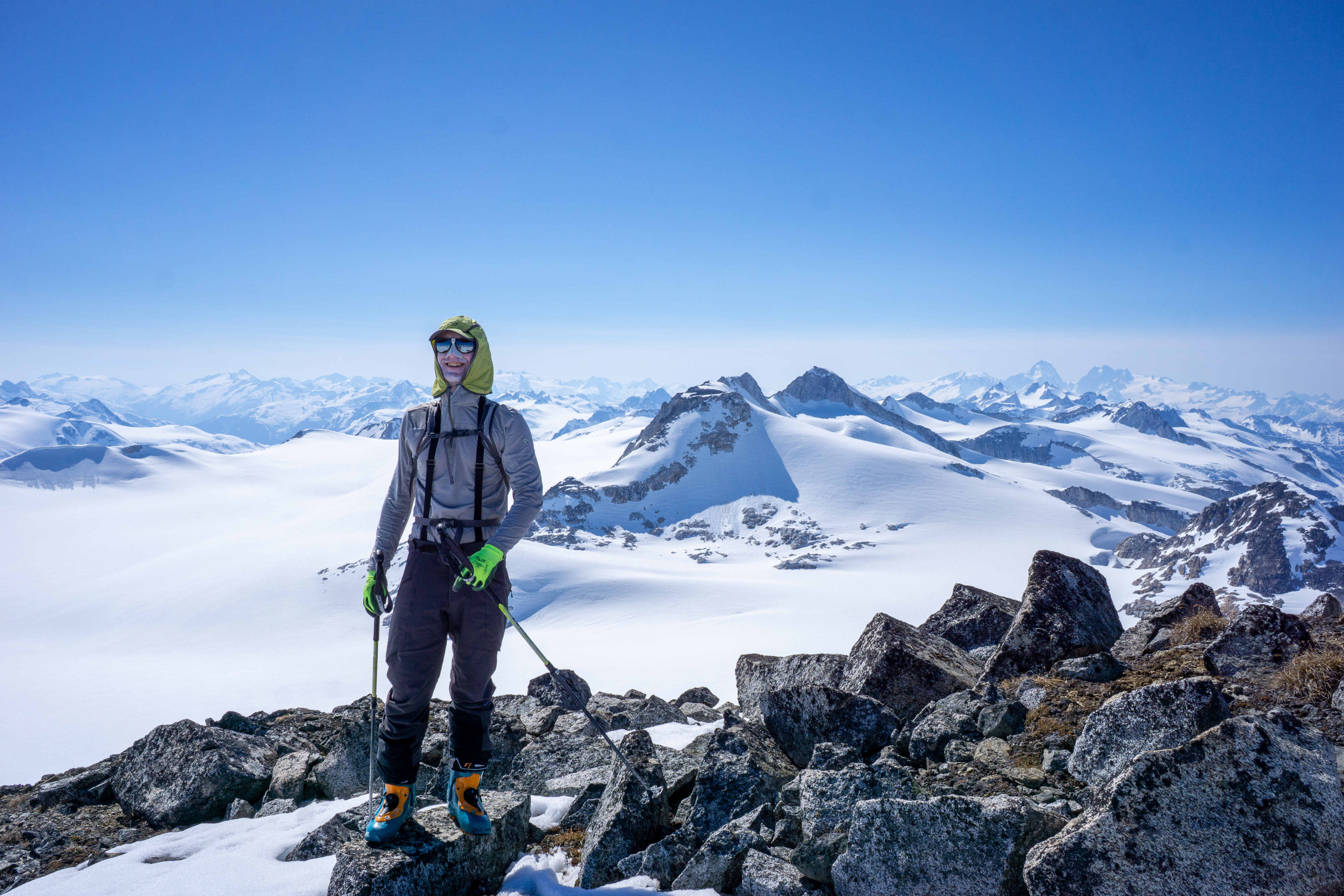
I am out of my comfort zone and don’t even bother – harder snow or no snow would make the difference, but as it is I head down the short steep snow and wait for the guys to give it a go. Andrew pulls off a challenging exposed move in ski boots and gains the summit. On the descent Ben helps spot him, but it is tricky and exposed – much more so than the photo looks.

We navigate some more wet, loose snow and then ski the north ridge back to camp. We eat a bit and hang out, but my energy is low. Ben and Andrew leave to go climb Pembroke, but I am worried the ridge looks too technical, so I hang out a bit in camp trying to make a decision. A while after they leave, I head to the St. Johns/Pembroke col and watch them negotiate the narrow summit ridge. After filming them with the drone, I make my way over to St. Johns and begin climbing the wet, central gully.


I find the snow too loose, so I switch over to the NW ridge. The rock is loose and steep, but within half an hour I am on the summit – my first solo peak in quite some time. I don’t spend long on the summit and retrace my steps before skiing as far back to camp as possible. The slog back to camp is brutal in the small bowl with no wind. I end up blasting some music to help me back where Andrew and Ben are relaxing.
Day Three: May 15, 2023
Sasquatch Camp – Ski Boot Scrambling
12km, 1200m, 9.5 hours
This morning we decided to try to take advantage of cooler temperatures in the morning and leave camp while it was still cool. We all had our best sleep of the trip, but Andrew was up at 530. After a nice warm breakfast, we head north around the little bump behind camp to access a glacier leading up to the south ridge of Cloister Peak. It provided an easy ramp to the ridge.
The final ridge to the summit is not challenging, but the rock is loose and tricky to deal with in ski boots. The main summit is slightly elusive down a narrow spine. It gives us pause in our boots, but would be easy in running shoes. We can see Chilco Lake and Franklin Arm from the summit – the only time of the entire trip. It is amazing how dry it is in the Chilcotin.

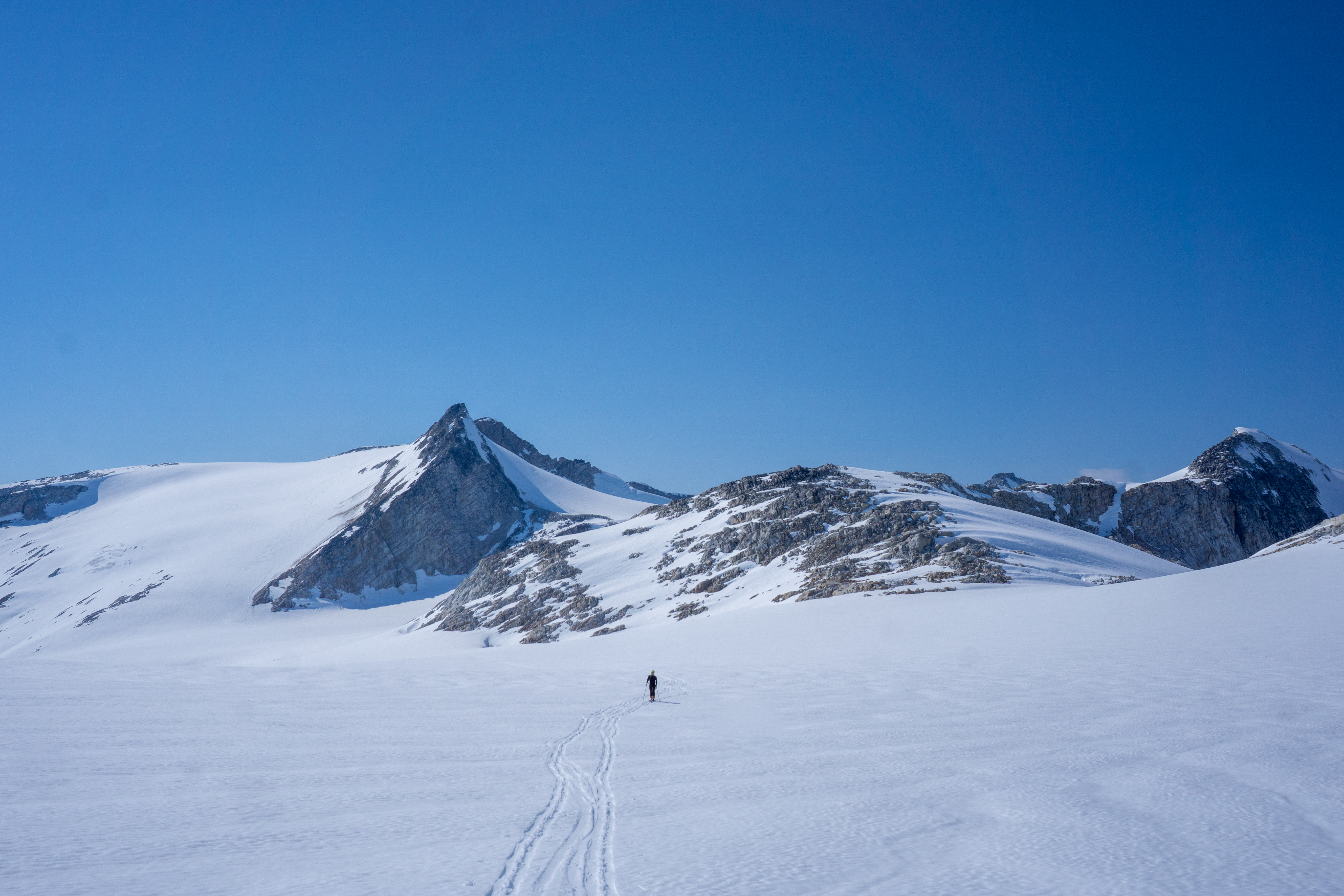
We retrace our steps to our skis and change plans. We had originally intended to ski a line back to camp and regroup, but we see an easy ascent on Walsingham Peak so we decide to take it. We ski our ascent route and then glide as far as we can to the base of Walsingham. A steep skin track set by Andrew takes us to a shoulder that we follow as long as we can on skis. From there it is a short and easy ascent to the peak.
The peak is lower and goes faster than we anticipated. We lounge on the summit for close to an hour looking at distant peaks, enjoying the sun, and eating.
Back where we left our skis, we transition and ski the north glacier to a small gap in the rocks to regain the main glacier. From here we skin west toward Howard and take a finger of snow as high as we can on skis. We had hoped to climb Burghley on the way, but can see no way up in ski boots – perhaps in runners or climbing shoes.
Howard ends up being an unexpected grunt. Ben keeps the skis on as long as he can and skins a narrow couloir of snow while Andrew and I boot pack. The scrambling, while always easy, is steep and the rocks are loose. We occasionally take snow slopes but we often punch through and end up back on the rock. The summit offers great views of Sundial Peak and all the peaks that we have climbed from our first camp.


The ski back is painful in wet heavy snow and then we have an hour skin back in the heat. At least the wind picks up and we get a nice cooling breeze.We enjoy a nice last dinner at our camp and a final sunset on Pembroke and St. Johns.

Day Four: May 16, 202
Sundial High Camp – Timepiece Peak
15km, 1000m, 6 hours
I have another fitful sleep – not enough time in the tent this year and I am still only getting a few hours each night. When Ben and I get out of the tent, Andrew has been up a while and the sun is already shining brightly.
We have a leisurely breakfast and break camp shortly after. We are on the go by 9 with only about 8-10 km until our next camp. Not very far, and only about 300m elevation…but the bags are terrible. This is our first day moving with them, and Andrew has designed the trip so that each camp move is minimal and most of our distance is covered during day trips. It is a great style!

After passing the familiar terrain to Sundial Peak, we start to climb to the pass just south of the peak. After a short break at some boulders, we are dropping our bags by 1130. There are some nice sharp rocks to rest on and nice flat snow nearby to camp on.

We lounge for an hour in the sun resting and eating. Our plan was to climb Nunatuk Peak, one of the few named peaks on this side of the icefield, but it is 300m below us and seems like an odd objective. The unnamed peak to the west of us seems like a far better option instead.

In the heat we take turns breaking trail to the summit, which we can almost skin right to. Andrew stops 20m below and we scramble the final section. The views to Queen Bess and Waddington are amazing! We can also look up the glacier we have been travelling on the past few days and the peaks we have climbed and skied. There are no records of previous ascents and we decide to name the peak Timepiece Peak in keeping with the loose theme of the area (Pelorus Peak and Sundial Peak are both instruments used to quantify something). The ski back down the face is fun, although the snow is heavy and wet.
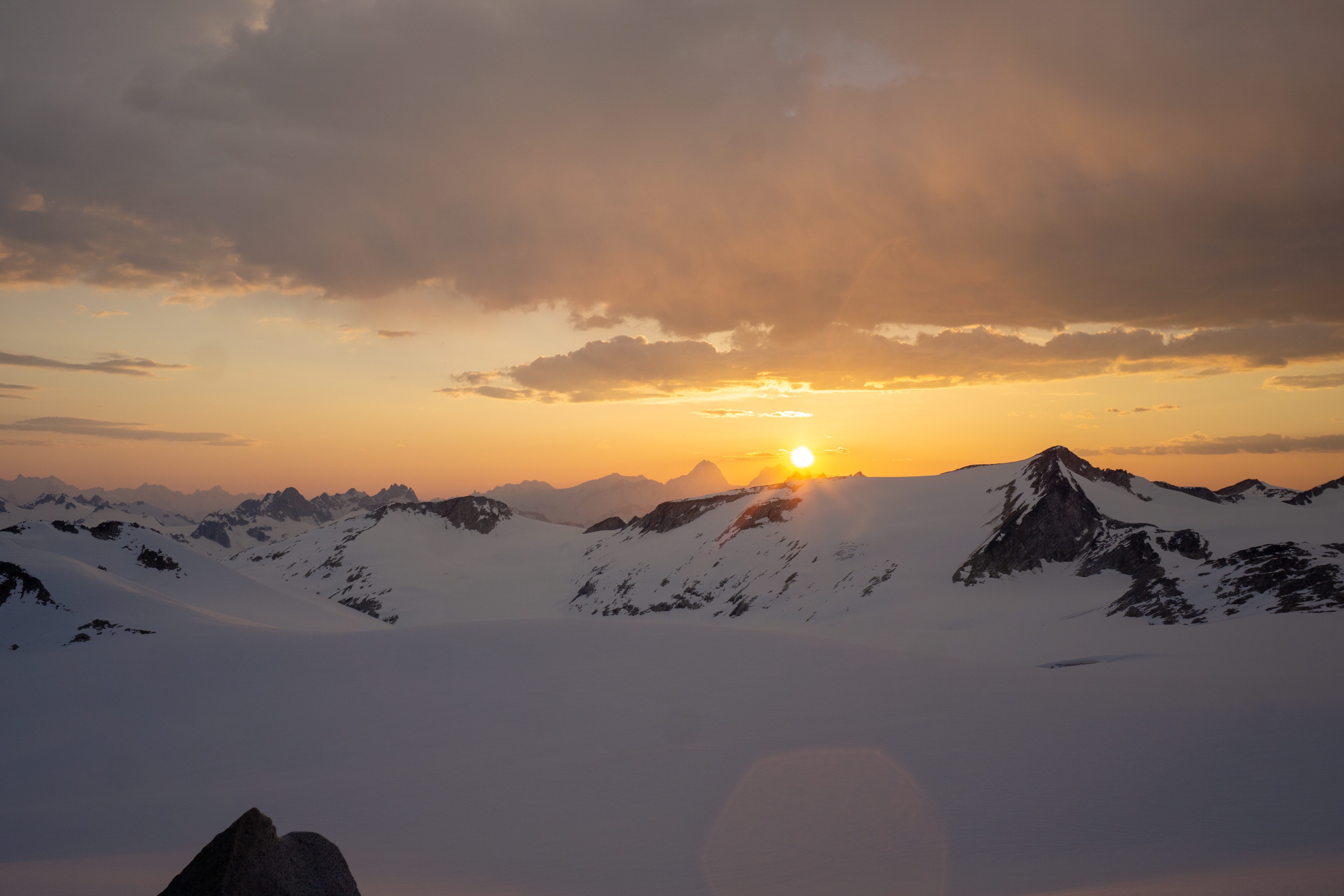
When we get back to our camp, the clouds begin to build and it is not long before it is windy and cold. We have a couple small rain showers but manage to hunker down in the tent and stay dry. It doesn’t last long and we are able to sit out and enjoy the sunset over Waddington while we eat.

Day Five: May 17, 2023
Cache Camp – Smoky Rest Day
13km, 350m with bag, 4 hours
When I wake up in the middle of the night my throat is hoarse and I can smell smoke. I hope it blows through overnight, but it feels thick.

In the morning, Andrew is up early as usual. A planned morning ski by him and Ben is put off due to the smoke and we all lay low for a few hours. It is smoky, but not too bad – we can still see the distant peaks like Waddington, but only barely.
We decide to still move camp today in the smoke to where we left our food cache. It will be a short day crossing the Upper Jewakwa Glacier. There is a steep run down from camp, but with the heavy bags we choose the more mellow option and head east before turning onto the massive glacier. We cross a grizzly track heading up from the valley and skin through a small icefall with bare ice and past an electric blue lake. It is early May and the glacier is already melting at an alarming rate.

After a short climb, we take a break at a pass only about 2km from our food cache a hundred or so meters below us. We leave the skins on and reach the cache shortly. It is just as we left it and no bears or wolverines have found it yet! It is only 2PM when we arrive, but Andrew and Ben don’t want to ski in the smoke and I want to rest my knee. We pay for our rest with 5 hours of direct sunlight while we terraform our camp to suit our needs better. It has a great rock to rest and cook on and we spend the afternoon hiding from the sun and reading.

Day Six: May 18, 2023
Mouse Camp – Pelorus
6km, 400m, 2 hours
I sleep in this morning. Ben and Andrew are off to climb an unnamed peak we can see from camp while I rest my sore knee. It has been quite smoky for the past 36 hours, but the skies seem to be clearing as the day goes on. By evening the smoke will be mostly gone. Ben and Andrew are successful climbing and skiing the peak, and name it Tipping Point Peak – for the large icefall they can see on the Heakamie Glacier.
While I sit at camp waiting for them, I find a large branch and root system in the recently uncovered rock outcrop we are camped by. It is intriguing to think how it got here, as the rock we are on has obviously only recently been deglaciated. For a while I cannot see Ben and Andrew and I end up flying the drone to have a look for them, eventually finding them in the vastness of the ice.

After they spend some time relaxing back at camp, we all head for the nearby Pelorus Peak. The topo map incorrectly labels Pelorus as a minor bump, but we head for the true summit. It is mostly skinning that takes us to the summit and a short scramble. At the top, we find our first register – John Clarke was on this same summit in 1984. The peak is an oasis of life, lush with moss, lichens, and other hardy alpine plants.


After taking in the views of the Jewakwa Glacier and the dramatic icefalls below Queen Bess and the Klattasine Range, we descend back to our skis. The ski down is fun through rocks with tight turns, but the snow remains slushy and wet. We have amazing travel conditions and super safe snow, but the weather prevents us from getting quality corn snow.
We decide to ski to the ‘officially’ named Pelorus Peak and dub it Polaris Peak (the name we have been incorrectly using for Pelorus Peak). It is a minor bump that we are able to ski to the summit of. Andrew considers continuing along the ridge to the true, unnamed highpoint, but it seems to be a 2+ hr journey and the day is getting late. We all turn back together.

We leave our skins on for the short ski back to camp to not hassle with transitioning again. Back at the camp, we pitch our tent again and begin to organize gear. As Ben picks up his backpack a little mouse dives down to the bottom. It takes a bunch of shaking to get him out and he scampers off to the rocks! It is the first mammal we have seen on the trip.
The smoke is continuing to clear and is being replaced by clouds. Still a preference over smoke. It begins to rain sporadically and we eat dinner in the tent. After lounging for a bit, we have one more task to do before bed. We must burn our food cache box – a task we do with great gusto, and thankfully the rain holds off!

It is nice to sit around a campfire surrounded by nothing but rock, snow, and ice.
Day Seven: May 19, 2023
Plateau Camp – Main Icefield Traverse
20km, 500m with bags; 2km, 250m, 10 hours
Last night when we checked the forecast we were disappointed to see a weather system moving in earlier than we anticipated. We came to the conclusion that we would have to fly out earlier, and our pilot agreed over text. This would cut our trip short by four days, so with this in mind, we decide to pack up camp and push towards Mount Grenville on the south end of the icefield.
We leave camp at the leisurely time of 9AM with the heaviest bags of the trip, each with seven days of food remaining. It is sunny and hot, but at least today there is some breeze to keep us cool.
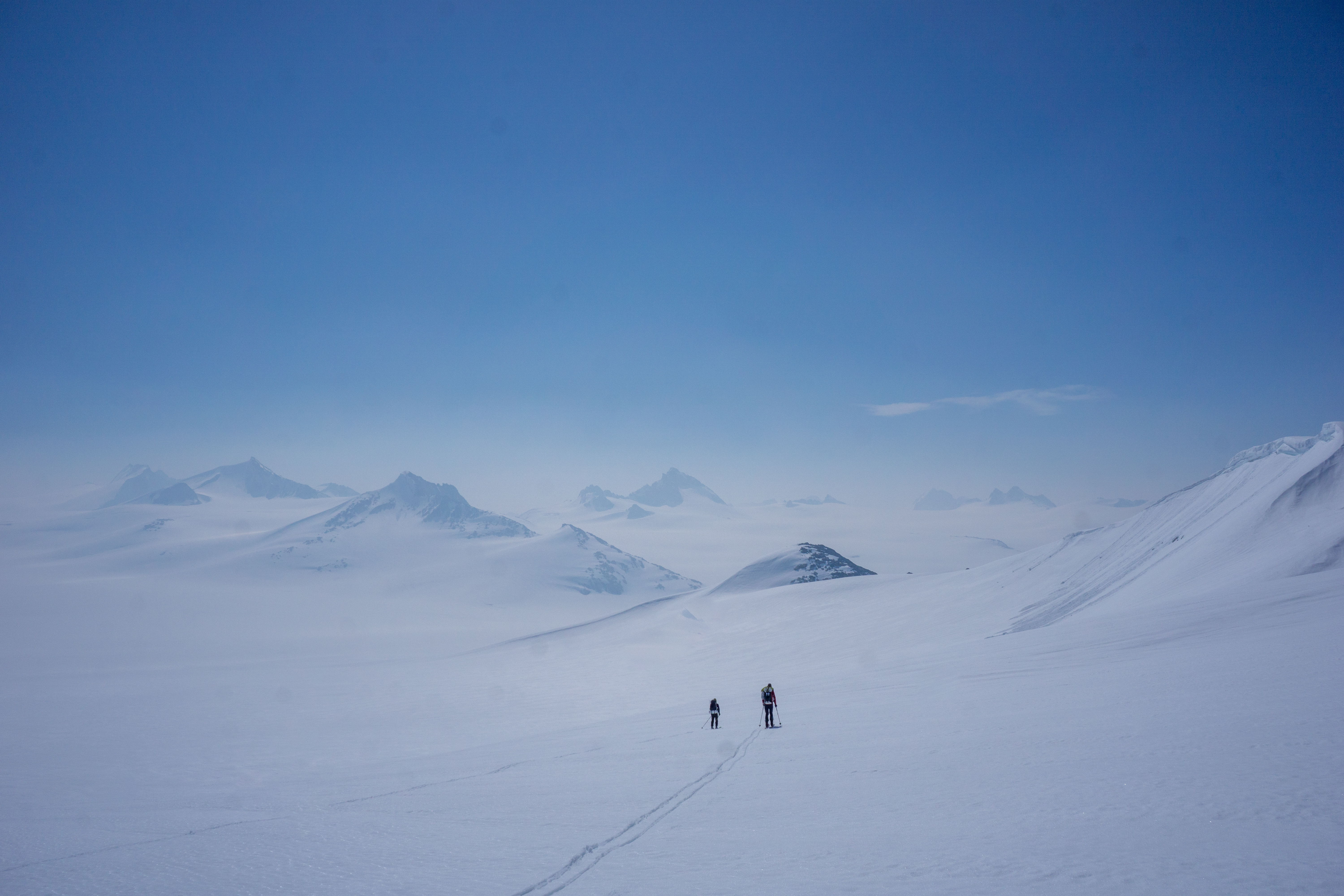
We move east from our camp and climb a small rise to traverse north around some rocky peaks jutting out of the glacier. The travel is easy despite the bags, but the conversation is sparse today. Ben and Andrew lead for most of the morning as we make good time travelling the divide between the Jewakwa and Heakamie Glaciers. After two hours of travel, we turn up a broad valley between two peaks and climb to an overlook of the upper Heakamie Glacier and the main body of the Homathko Icefield.


We drop our bags and climb a small rise for views over the icefield. The scale is hard to comprehend. Plateau Peak across the glacier appears quite close, but the GPS shows it to be 7km away! Despite it being only May, there are melt water ponds all over the glacier.

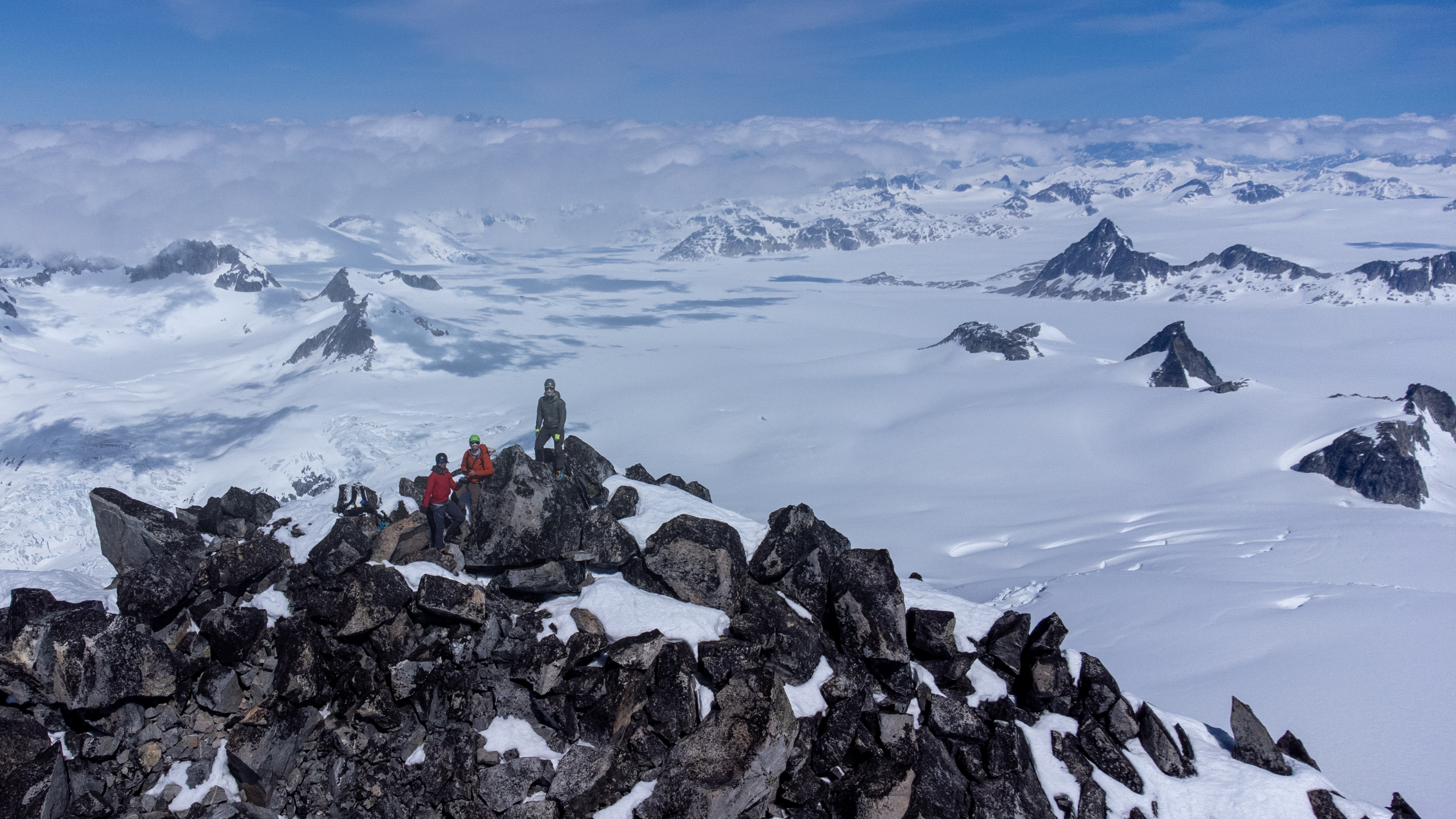
We eat some food and then begin the two-hour trek across the glacier to a col immediately to the east of Plateau Peak. Looking at the aerial photos before the trip, we were uncertain if Plateau Peak could be easily submitted in ski boots. As we approached the SE ridge though, we noticed that it looked fairly simple on continuous snow to a rocky tower.
From below the tower, we scramble exposed third class terrain to gain the narrow summit. At the top, we found our second summit register of the trip. This one was from the first ascent party in 1969. There was no evidence of a second ascent. The views were great and offered a vantage over all our previous objectives and Mount Grenville’s north side.

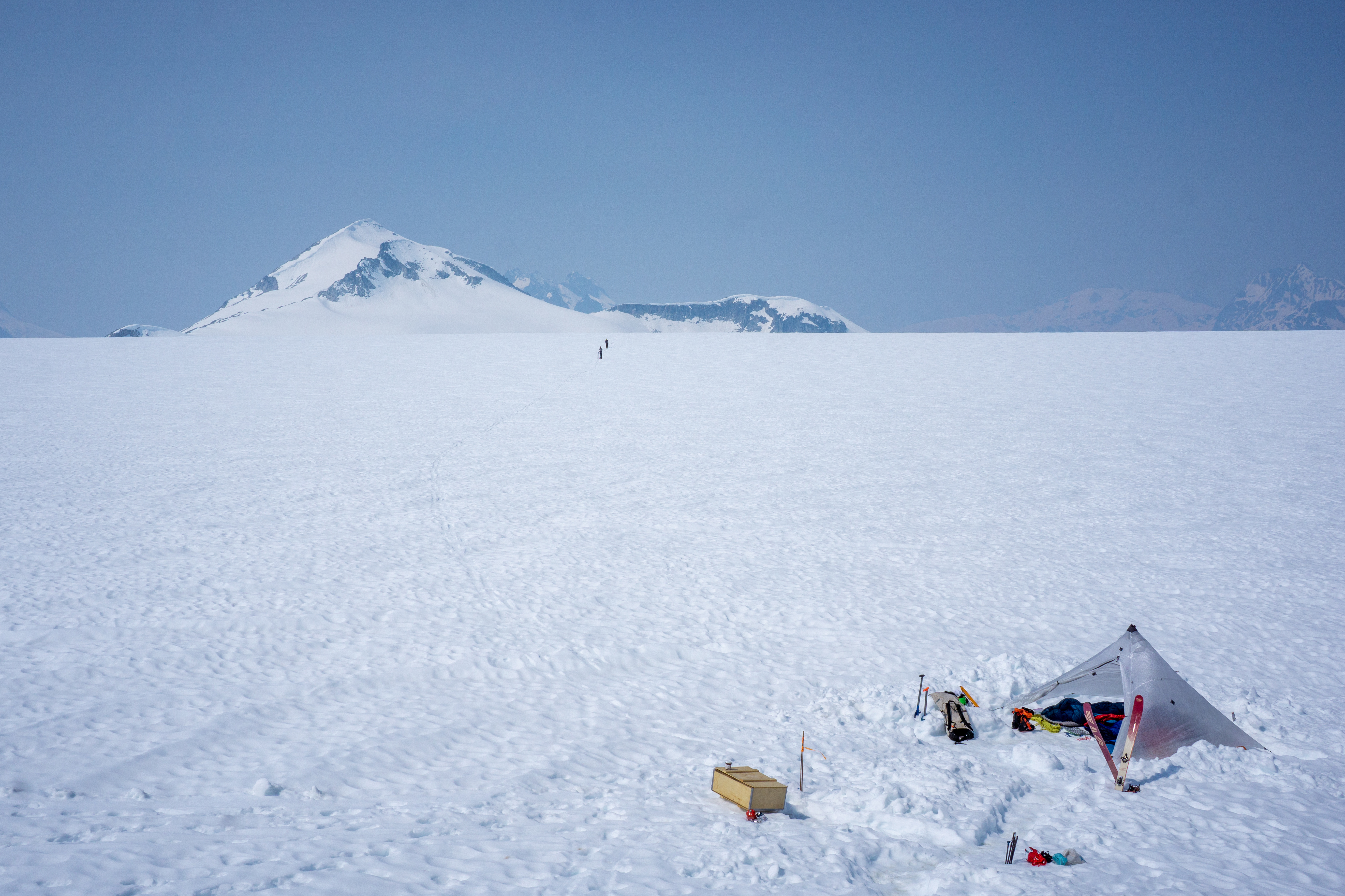
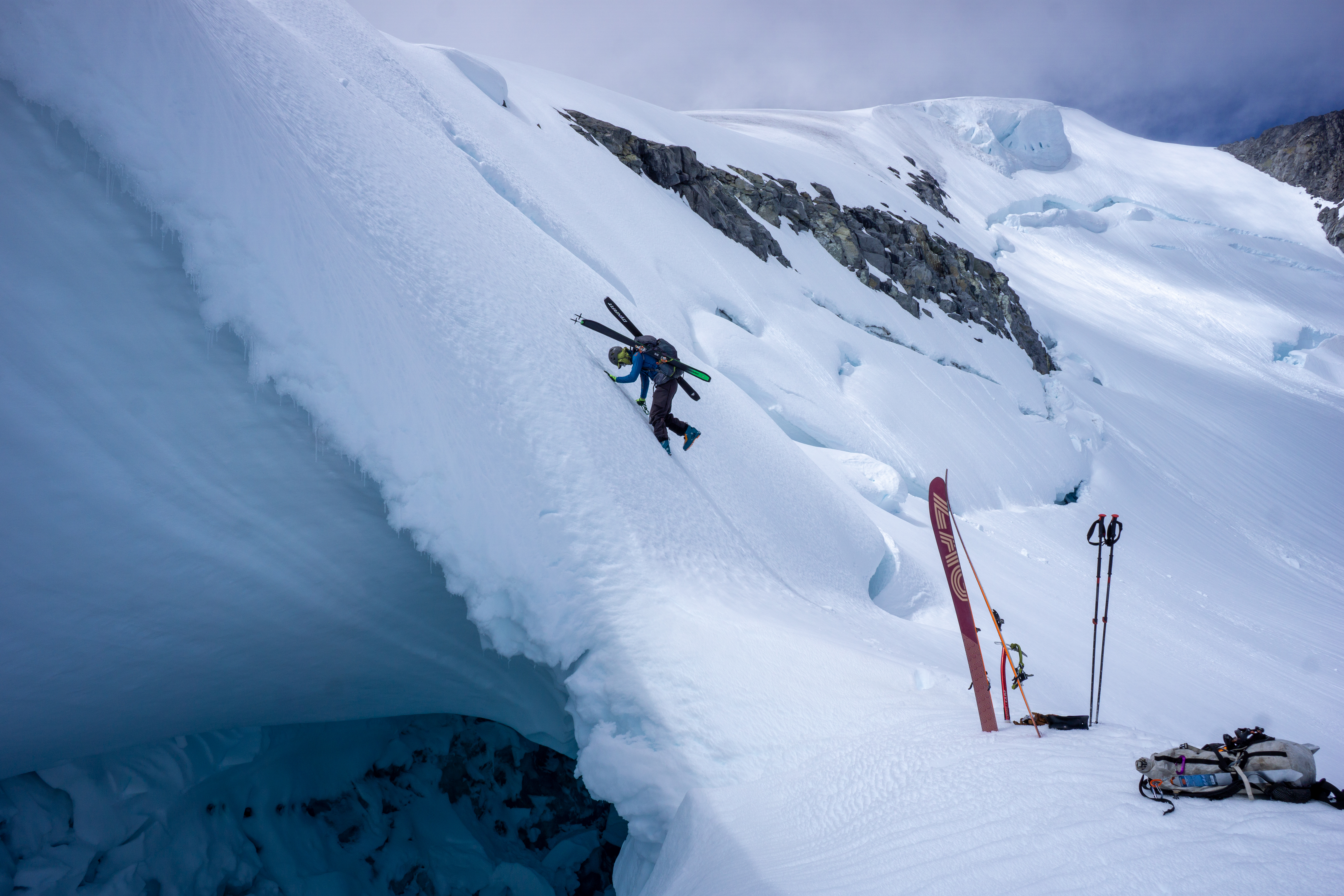
It had taken much longer to scramble the ridge than expected and we were now faced with a steep, loose bootpack below the col to regain the icefield. Instead of continuing further to Grenville, we elected to deal with the gravelly bootpack and make camp below Plateau Peak. The bags were even more fun to carry with skis strapped to them.

Our new camp would leave about 10km to the summit of Grenville, but we much preferred to do it all without the loaded bags then any of it with them. We skied slushy snow to a rocky outcrop and set up our final camp. The sun disappeared behind Plateau Peak quickly and for one of the first evenings of the trip we were chilly. It had been a long day already, so we ate quickly and got into the tent with a 5AM alarm set.
Day Eight: May 20, 2023
Mount Grenville
20km, 1100m, 6 hours
The alarm goes off at 5 and we all wake up at our own speed. The sky is clear, but we can see clouds building around Grenville. I don’t eat much for breakfast, but Ben and Andrew each have a hot breakfast and then we grab all our gear and march towards the main objective of the trip, uncertain if the bergshrund will be bridged.


We make good time crossing the flat glacier and begin climbing the lower northern flanks of Grenville. For the first time in the trip we are travelling over icy snow, but the terrain is mellow and the glacier rolls gently. It only takes us two hours to reach the bergshrund below the final summit ridge. It is bridged well and we cross easily.

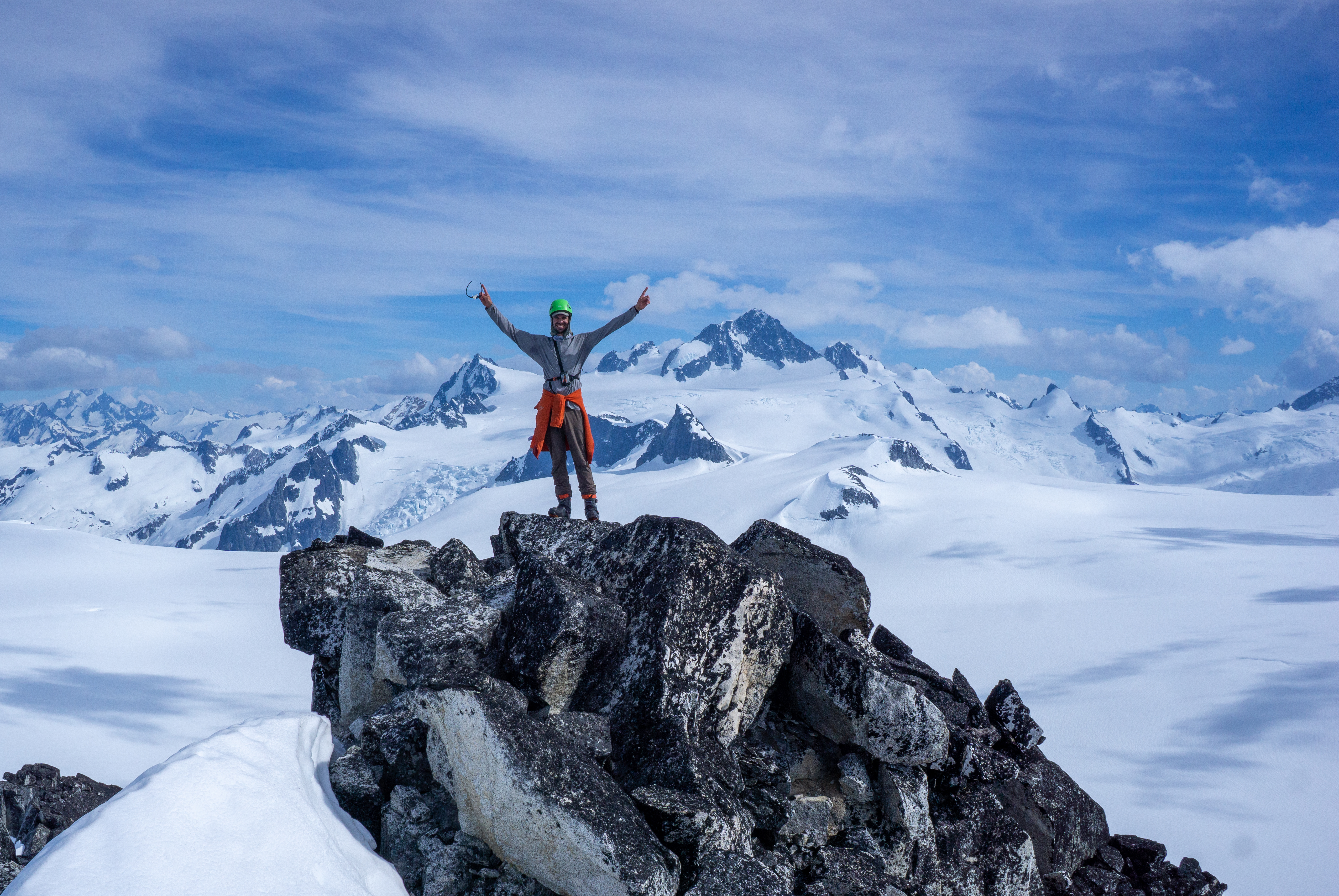
From here we leave the skis and boot the final 250m to the summit. It is my highest summit in the Coast Mountains at 3,126m and we all feel super stoked to be have made it here. Clouds are dense over the inlets and once again I worry about things beyond my control, wondering if a heli can land today. We sit on the summit for a while, but the wind and cold send us back down fairly soon. Andrew has carried the drone up and we launch it from the summit. It is quite unhappy in the high winds at 3200m, but we get some fun shots. The walk back to our skis is through clouds and mist, but after we bootpack back over the bergshrund, we are in sun again.


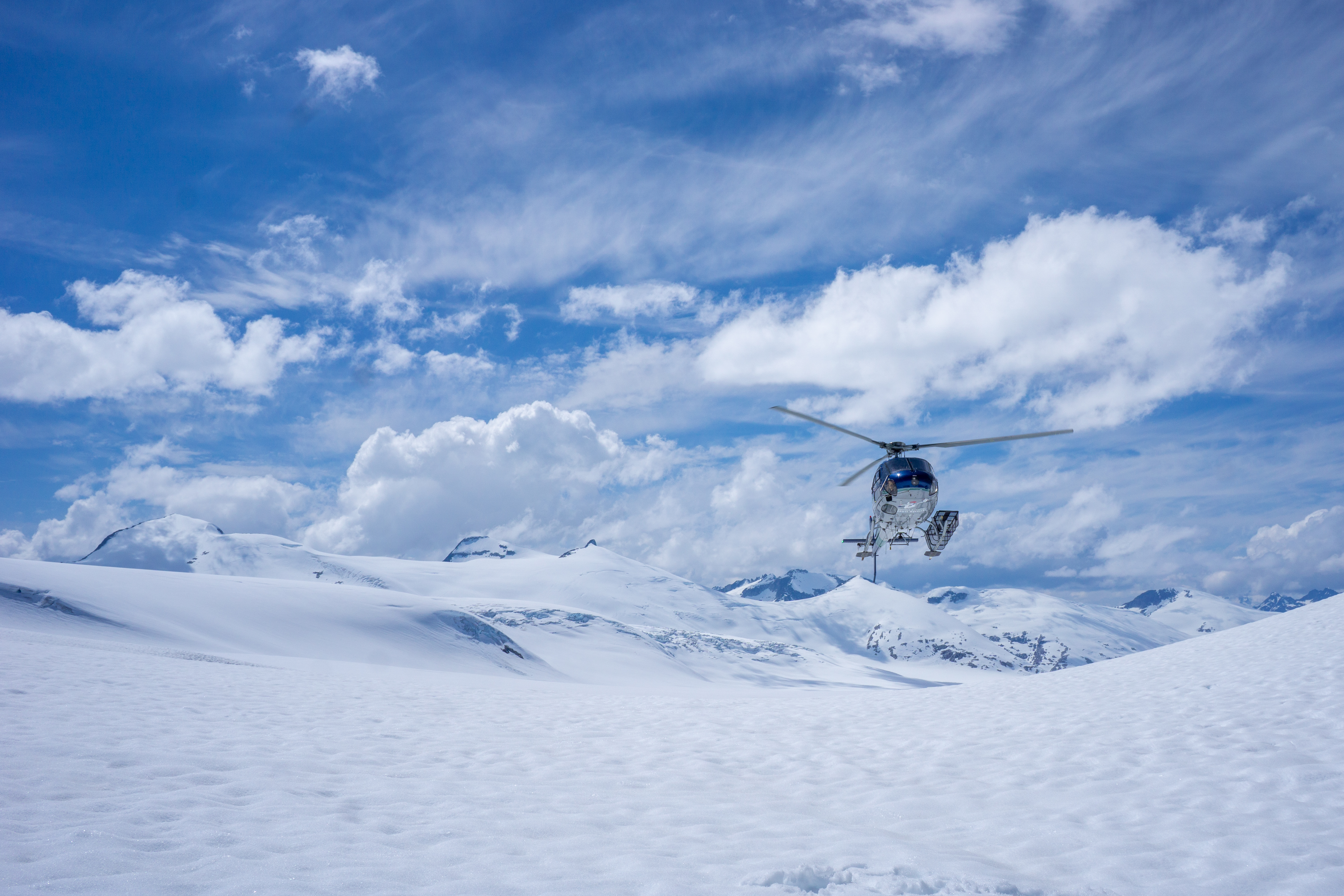
The ski down the glacier is one of the best of the trip and we have fun making turns back to a low point where we need to transition again to skins. After a short climb, Ben and I take the opportunity to ski one more time before we need to skin the flat glacier back to camp. The round trip has taken us six hours and we contact Tyler to take us home earlier.

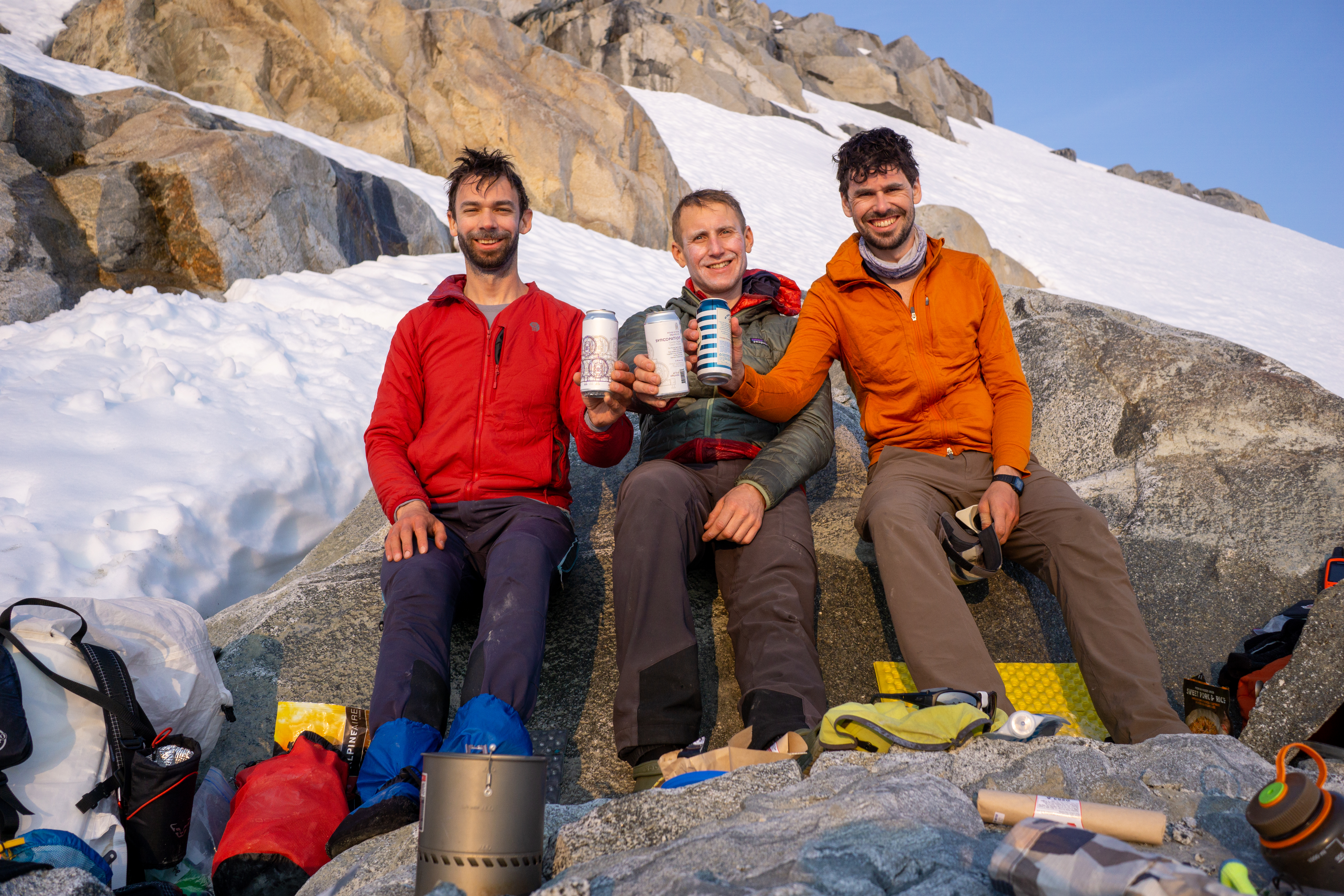
We dry things in the sun and repack our bags, dragging them a short distance to a more appropriate landing spot. Around 3PM we hear the heli coming over the icefield and say goodbye to the Homathko. We load up without shutting down and are off quickly – ever minute costs far to much to lollygag. Tyler has brought us cold beers and gives us an amazing flight back to Campbell River.
We fly the entire length of Elliot Creek, where a massive slide occurred just two years ago. The destruction is epic and the scale is hard to comprehend. As the ice retreated in the valley, a large section of land was left unsupported. When it collapsed, it registered the equivalent of a 5.0 magnitude earthquake on the Richter Scale and clogged Bute Inlet with debris for months. Tyler takes us over Orford Creek and past the north face of Dougie Dowler – two spots I know well; the tidal rapids are all going at full flood and very dramatic to see from above. It is a fantastic way to end a great trip to a remote and stunning area on the BC Coast.
Anthony
May 25, 2023

Wow, wow, wow! I was thrilled to join you on this incredible adventure safe at our kitchen table on a beautiful, sunny day. I kept oscillating between these two descriptions: “these guys are amazing” and “these guys are crazy”. Well done!
LikeLike
I heard there was a grease trail from Bute Inlet over to the Chilcotin. Would you have seen the route area either going in or out?
LikeLike
Hi Doug, I have heard of such a route as well, but unfortunately we did not see any evidence from any of the peaks or during the flight in or out! I think that one may have been lost to time and the forest. Cheers, Anthony
LikeLike