
Second Half: Days 5 – 8
This is a trip report for the second half of an eight-day mountaineering trip traversing the alpine divide to the south of Toba Inlet. We had just travelled for 4 days from Daniels Lake to Daniels Peak and the day before had completed a nearly 900m climb back to the alpine from the low point of our traverse. We were camped high on the shoulder of Daniels Peak overlooking Toba Inlet.
To read about the first half of the expedition, click here.
Stats & Route Map
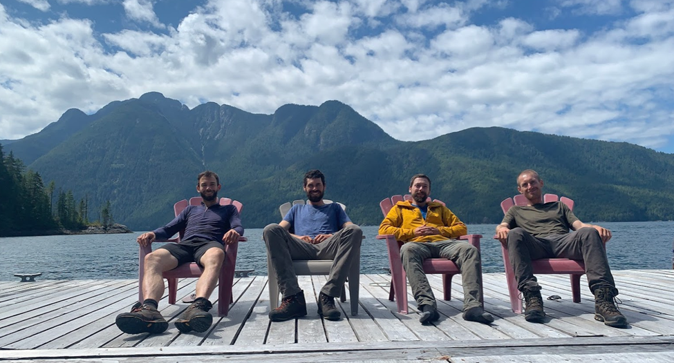
Participants: Andrew, Ben, Daniel, Anthony
Dates: July 8 – 15, 2021 (8 days)
Distance: 104 km (GPS)
Ascent: ~ 9715 m (GPS)
Peaks: 18

Day Five: July 12, 2021 – The Alpine Camp
Summits: Daniels Peak, Darius Peak, Worms Peak, Alpine Peak
We woke to another perfect morning on the South Toba Divide. As usual though, we paid the price as we were already sweating by the time the tents were down. Yesterday had been difficult and we were all feeling a bit tired – it was nice to start so high up though as we didn’t have far to carry the bags. The summit of Daniels Peak was only about 50m above us.

We were particularly excited for this peak as according to some sources, it was unclimbed. Heading up the last few meters, Daniel charged ahead to claim the first ascent of his namesake peak. However, as we crested the final ridge, a large cairn greeted us. It appears that this peak has indeed been climbed – perhaps by the same solo climber who left a note in the Endspur register in 2010 on an ambitious trip from Denman to Squamish!
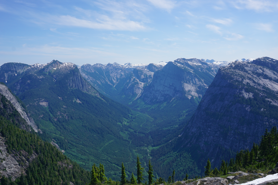
Despite not getting the first ascent, the views from Daniels were phenomenal. All of Toba Inlet was stretched out before us and we could see for hundreds of kilometers: the peaks around the Tahumming looked particularly beautiful and as usual, the Daniels Valley was in full display.

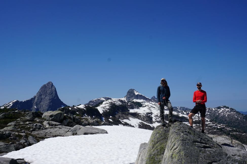
We lingered on the summit for a bit, we were excited for another day of travelling on the ridge, but were enjoying some time standing still. After taking a rare group shot, we packed up and began travelling towards Darius and Worms Peaks. These were two of the lower peaks we would climb, but we needed to traverse over them.
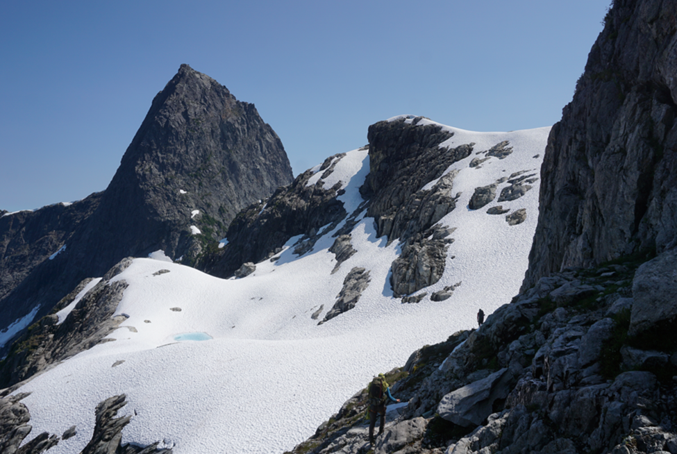
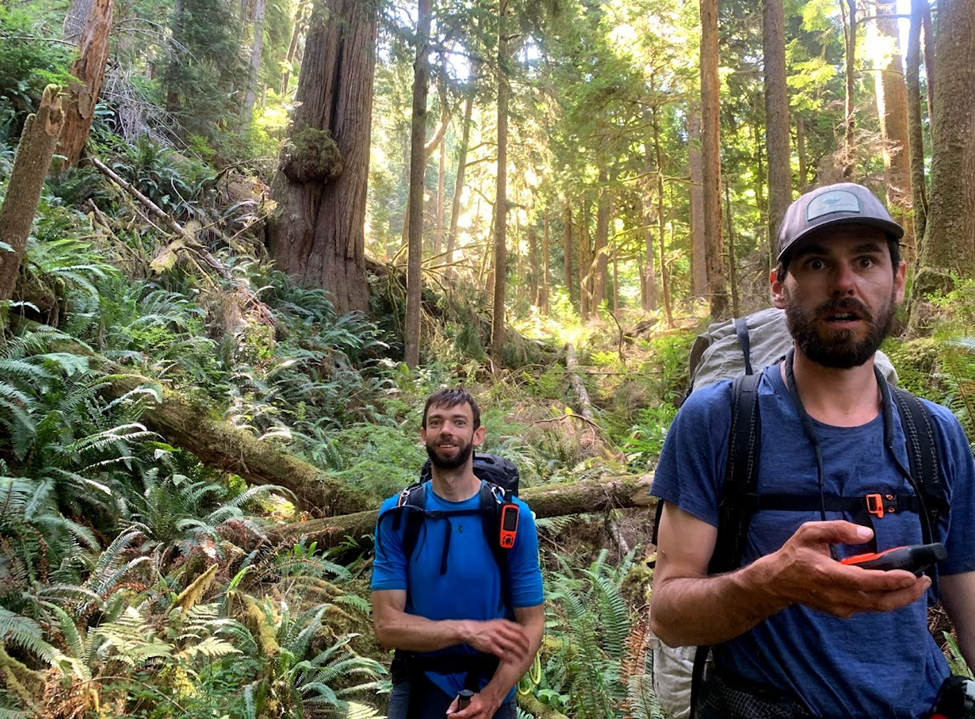
The ridge dropped and then narrowed and we encountered some bushy and bluffs sections. Darius Peak was an easy hike and offered amazing views down the Daniels Valley, but the descent towards Worms Peak was challenging. We veggie-belayed our way down steep bluffs to a broad ridge and then once again had pleasant walking through sub-alpine forest.

We easily hiked over the summit of Worms Peak and then gained the SE ridge of Alpine Peak. The travel here was easy, and we quickly gained the south shoulder of Alpine Peak where we ditched our bags and had a well-deserved rest. After a bit, we rallied ourselves and headed up the remaining hundred or so meters to the summit of Alpine Peak.
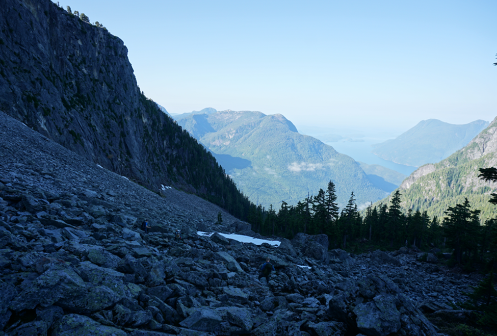
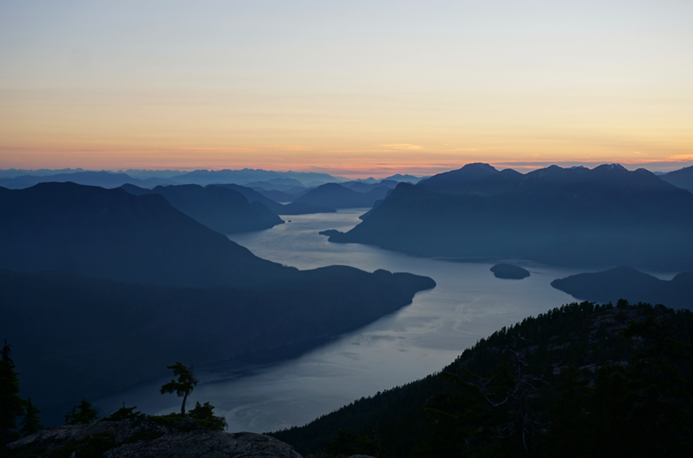
The entire day, aside from Daniels Peak, we only had fleeting glimpses of Toba Inlet, but from the summit of Alpine Peak the inlet was once again laid out below us, shimmering in the sun. I realized I had seen the summit of Alpine many times during paddling trips up the inlet. The glacier on the north face of the summit I had also seen from the water – it is small and shrinking fast. One of the most spectacular waterfalls on the coast is supplied by this glacier; I don’t imagine it will last long with more of these ‘heat domes’.


We were in no rush as we planned to camp somewhere high on the SW ridge of Alpine Peak. We enjoyed the views of the inlet and named as many peaks as we could, planning future trips to the remote parts of the Coast Range. We packed up our water bottles and headed back to our bags with the familiar view of Denman and Aiken looking much closer than ever before.
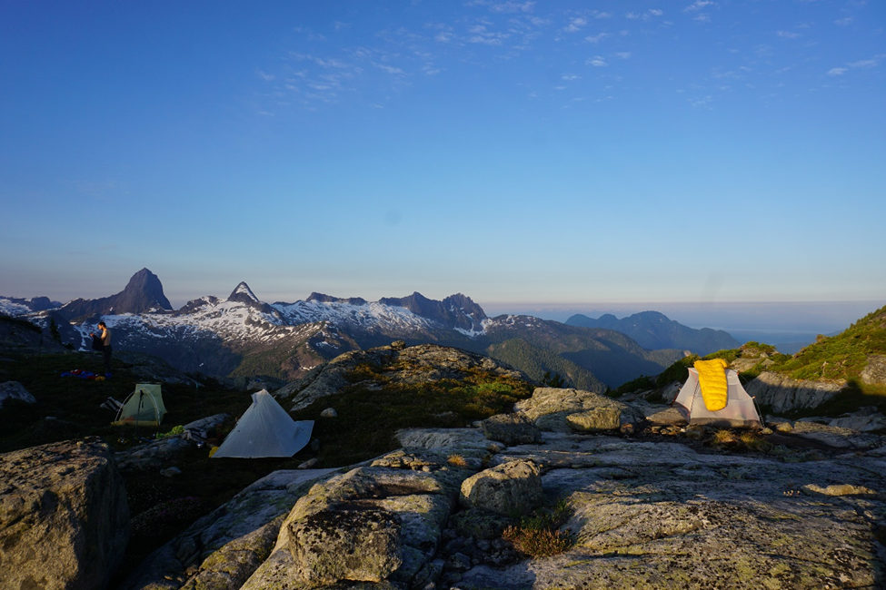
Back at the bags we started looking for camping. It was one of the few nights we disagreed on a location, and we ended up hiking for about 30 minutes before we all came to an agreement. We had shade from the sun, flat areas to pitch the tents, running water, and a small tarn to swim in. Unfortunately, the tarn was full of dragonfly larvae that liked to nibble on our feet, but we managed to cool off in the shade of some large boulders.

We sat around after dinner enjoying yet another spectacular sunset over Mount Denman. Our vantage from our camp allowed us to see our route to the bowl to the west of Mount Denman, where we intended to camp the following night. We could see an unexpected crux on the ridge getting past Derwent Peak (the peak to the NW of Denman). On the topo, it looks easy to bypass or go over this peak, but in reality, it looked much more difficult – we were all curious how the day would go tomorrow.

Day Six: July 13, 2021 – The Spring Camp
Summits: Homfray Peak, Sparkler Peak
Yet again, we were blessed to wake up to another glorious sunrise and weather forecast. I was up before everyone and made some tea and sat around reading. Today promised to be a great day, but we were all curious about how to get past Derwent Peak.
We let the sun dry some damp gear while we ate breakfast and then set off along the curving ridge towards Homfray Peak. We had to lose a fair bit of elevation and the going was fairly quick. The ridge was broad and travel was easy. Before long, we were at the col between Alpine Peak and Homfray Peak and began the slow hike up.
Homfray offered some great views, but it was nothing special and was merely a bump on the ridge that we had to traverse. We left Homfray and continued along the ridge towards Sparkler Peak. We were all tired and feeling the heat of the past few days.
We decided to take a rest in the shade of a large boulder and spoil ourselves: Dan’s cheese was getting a bit sweaty, and we all traded some with calories so that we could have a group fondue. What would have been far from palatable at home is a top memory of the trip.

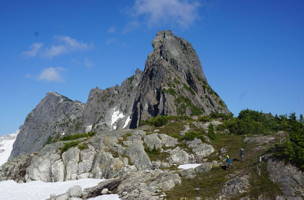
After that indulgence, we hiked the remaining few hundred meters to the summit of Sparkler Peak. From here the route to Derwent Peak was obvious and easy, but beyond that we were still uncertain of the way.

It looked like we could continue along the ridge to the base of the peak and then take a sloping, tree-covered ramp to gain the east face and traverse across. At the worst-case scenario, we still had the rope that we were carrying around.

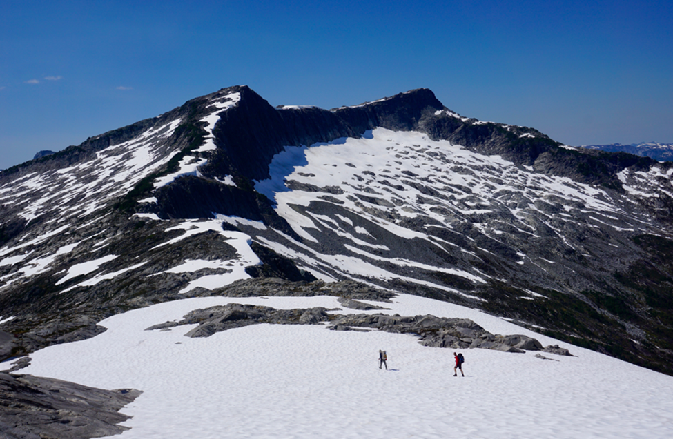
We found the ramp and managed to downclimb it without the rope. From there the travel was straightforward. We climbed steep snow and finally gained the ridge overlooking the bowl to the west of Mount Denman. We could see the meadows and slabs where we wished to camp that night.

However, what appeared to be only 15 minutes on the map, ended up taking much longer, as we could find no easy way down to the meadows. We ended up veggie-belaying ourselves over a short cliff and then scrambling down some loose terrain to get down. From below, it looks like there are several options, but none easier than the way we came.

We took a bit of time to find the perfect site – heather always looks so nice and flat and inviting from afar, but that is not often the reality. We walked back and forth across the meadows until we found a nice clump of trees that provided shade. There were slabs and small tarns everywhere and I pitched my tent in the heather by a small spring, while the others found their own sites.
The northwest face of Denman loomed over our camp, and we had great views down to Desolation Sound. The bugs were not that bad here and we enjoyed a lazy evening. We were getting low on food and we each did a tally of how many calories we had left – not many! Tomorrow we would attempt to summit Mount Denman and then move our camp for a final time. We were still interested in climbing Mount Aiken, but were worried that with the technical nature of both peaks and our 2PM pickup time in Homfray Channel, we would not have time for both.

Day Seven: July 14, 2021 – The Mega-Tarn Camp
Summits: Mount Denman
Amazingly we woke to yet another day of sunshine. We wanted to get going early to see if we could squeeze in Aiken as well, but ended up getting off later than we thought. We crossed the bowl back towards Denman and then descended a boulder-field for a few hundred meters. Going was quite slow.
We were not sure if the entrance to the ridge would be obvious – and it was not. At some point though, we decided we were low enough and turned to gain the ridge. The climbing was all in the forest, but it was steep and loose and was some of the most dangerous terrain of the trip. About halfway up we picked up a rough foot path and the going got much easier.
On the ridge we had a perfect view of the south face but could not see a distinct ledge crossing the face – the known route on the mountain follows a 3rd class ledge across the face. In fact, there were many ledges we could see but none looked continuous or easy. We decided to continue until something looked more obvious.
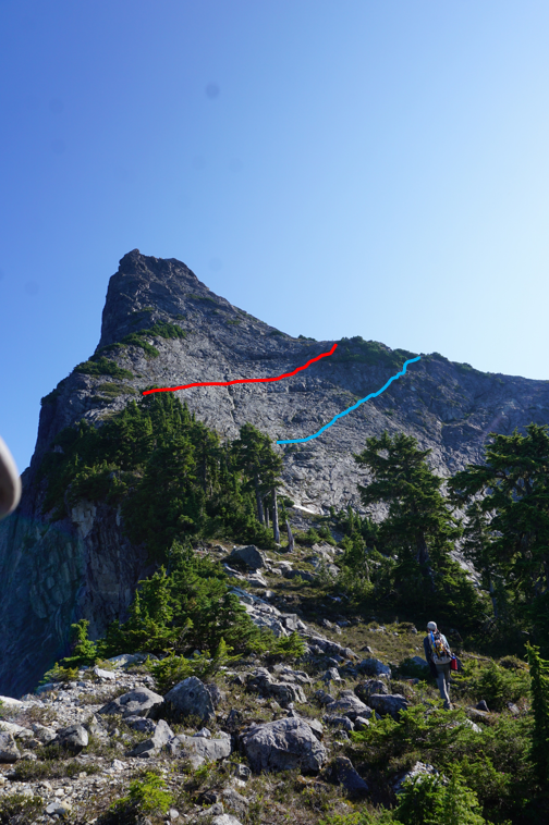
We hiked along the ridge until going up became difficult. Nothing obvious had presented itself on the face, but we committed to a small ledge anyway. I followed this until it disappeared. Instead of retreating and reassessing, we decided up was best and picked our way up the very exposed face. The rock here is not as grippy as the granite by Daniels Lake and the exposure was at the edge of my comfort.

We safely negotiated the face and gained the south ridge, where the terrain remained technical, but the exposure greatly diminished. After a bit more effort, we were all on the summit together, soaking in some of the best ocean views I have had from a mountain. Desolation Sound, the Redonda Islands, and Vancouver Island all stretched out before us, with endless views of the Coast Mountains in every other direction.

We took some time to rest and recover and then began the descent. We had noticed the correct ramp from above, but getting onto it was still difficult and exposed. Once on the ramp though, it was easy walking (but still not for those with a fear of heights). Getting off the ramp and through the steep forest on the far side was also quite difficult. I think finding and accessing the ramp are the cruxes of this scramble.

Anyway, we retraced our steps to where we gained the ridge and picked up the faint footpath which we managed to follow mostly back to the boulder-field. From there it was a trudge back to our camp, where we dunked our heads in the spring and sat around eating for a bit. We had all concluded that without a known route and our mid-afternoon pickup the following day, Aiken would not happen.
We still didn’t know how easy it would be to get around Aiken on the north side though, so we packed up camp and started walking. As we approached the west side of Derwent Peak, we debated trying to climb it, but we had no rock gear, were short on time, and it looked technical – oh well, one more for next time!
The north side of Aiken was mostly snowfields and we managed to cross quite quickly. The massive walls of Aiken towered above us. The terrain here is still quite large despite how low the peaks are, and the area was very impressive and felt remote. We slowed slightly as we began one of our final uphill climbs of the trip – I was more than a little physically destroyed by this point!
We gained the ridge to the west of Mount Aiken and started a long slow descent down a broad sub-alpine ridge. We were planning on reaching a lake in the forest, but after stumbling upon one of the best tarns of the trip, we had to stop and camp. Besides, we figured we could easily cover the distance to Homfray Channel in the morning.

We all stripped down naked and had a swim across the tarn – it was massive, and it was a great way to cool off after another dangerously hot day. We found a dry tarn nearby which provided the perfect flat and soft place to pitch our tents and we settled in for the evening. It was a wonderful last campsite in the alpine and certainly more desirable than being at the lake in the forest. It was still very buggy though and we covered up as best we could!

A two-minute walk from camp was a bluff overlooking East Redonda Island and the entrance to Toba Inlet. We sat out after dinner, drinking tea and watching the sun set. We had unintentionally saved the best for last and the colours and setting were surreal. We took it all in and then wandered off one by one for our last night of the trip.
Day Eight: July 15, 2021 – Homfray Channel
What a great last night it had been! We expected today to be a fairly easy one, but we still woke early to make sure we had a bit of a buffer to meet Peter. He was scheduled to pick us up at Klahoose Wilderness Resort in Homfray Channel at 2PM. Given his propensity for timeliness, we did not want to be late.
Klahoose Wilderness Resort is located on the steep shore of Homfray Channel, and I had reached out months before to see if they would allow us to meet a boat or plane at their lodge. Not only were they very open to having us come through the lodge, they were very excited about our trip and supportive.

We packed up our gear while wearing long sleeves, pants, and bug nets, as the bugs were out in full force. Breakfast had a little bit of additional protein in it, but none of use were protesting the extra calories. For the last time we hoisted our heavy bags on our backs and said good-bye to another fantastic campsite.
After that we began dropping quickly. We left the sub-alpine and started descending the steep terrain bordering Homfray Channel. Dan once again took the lead here – he had scoped out a route the night before on satellite images and was trying his best to lead us through the numerous bluffs.

The bushwhacking was severe and steep, but we were making quick work of the elevation. By noon we were past the bluffy sections and we found ourselves walking through pleasant mature forest towards the creek that drains into Homfray Channel near the lodge.

At last, we heard running water and saw some minor trail infrastructure and new we were in the right place. We dropped down to the creek and splashed to the edge of the ocean – our traverse was complete and had been highly successful!
We took our bags off and rested in the intertidal zone of the creek for half an hour. Our freshest clothes were pulled out of the bags, and everyone washed their faces in the cold stream water before we made the final two-minute walk to the lodge. The setting and buildings are gorgeous. We stumbled into a shocked staff – despite our emails, the person I was communicating with had forgotten to tell the rest of the staff. Unbeknownst to us, today was their first operating day, so justifiably, everyone was a bit stressed.
Nonetheless, they welcomed four smelly hikers into the newly cleaned lodge and gave us food, beer, and a place to sit and wait in the shade for the floatplane. We talked with some staff and then went and sat on the dock while we waited. Peter showed up and we loaded the plane. We flew down Homfray Channel and over the Redonda Islands, getting one final view of the traverse where we had just spent eight days.
It had been a stunning trip and wildly successful! It isn’t often the case on the BC Coast that you can plan a trip four months out and have everything go so well. The weather, the conditions, and the friends all aligned perfectly. Aside from a few sections, we had followed almost the exact planned route and climbed all the peaks we intended too. This is an amazing area that begs for more exploring, and I cannot wait to fly into Daniels Lake and head south!
Anthony, February, 2022

So cool. Congrats.
LikeLike
Thanks Jason! Was a great trip. Will be back to do more, just tied up for the next few summers!
LikeLike
Great trip report!
LikeLike
Thanks John!
LikeLike