
Second Half: Days 4 – 8
This is a trip report for the second half of an eight-day mountaineering basecamp-style trip in the Slim Creek Headwaters area of South Chilcotin Provincial Park. Dan and I had just completed our longest day of the trip, bagging five peaks by the Subatomic Glacier. We were settling in for a few days of bad weather before heading out to explore other areas around camp.
To read about the first half of the expedition, click here.
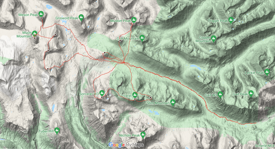
Stats & Route Map
Participants: Daniel & Anthony
Dates: June 27 – July 4, 2020 (8 days)
Total Distance: 94 km (GPS)
Total Ascent: 5050m (GPS)
Peaks: 12
Day Four/Five: June 30/July 1, 2020 – Long Stormy Days
Distance: 0km
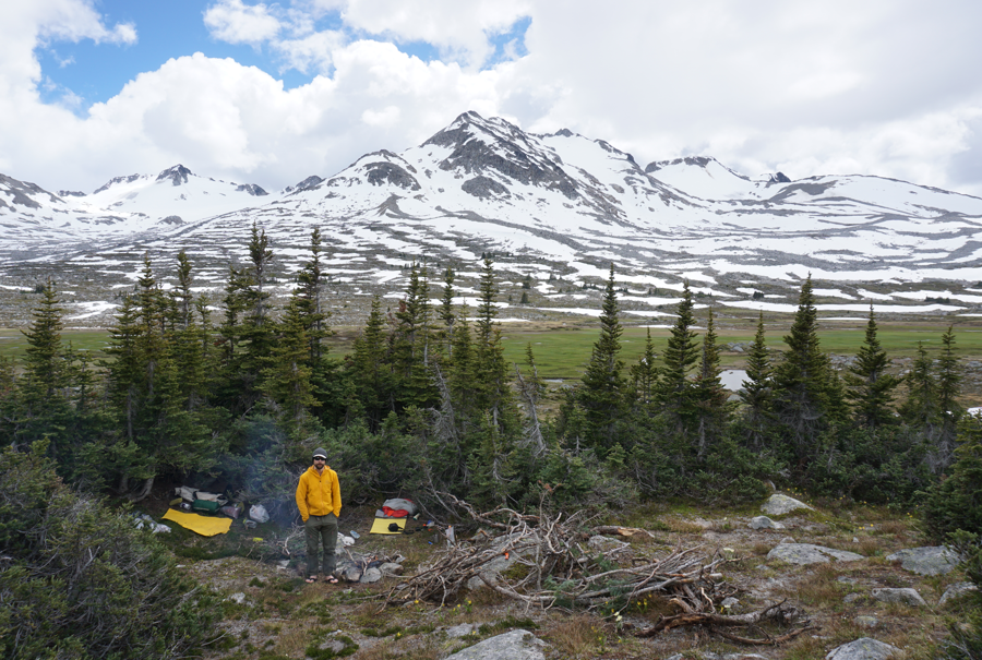
We spent day four and day five hanging around camp, relaxing, and hiding from the weather (which wasn’t actually that bad). We felt lazy and unmotivated. These days are a blur of good food, campfires, cards, and sleeping.
We hiked around a bit, gathered firewood, found a Robin’s nest, and did some yoga by the creek near camp. In the evenings we sat by the fire watching the marmalade skies or hung out in the tent playing Rummy and drinking hot chocolate.


Day Six: July 2, 2020 – Sorcerer Loop
Distance: 15km
Summits: Stanza Peak, Sorcerer Peak, Fantasia Peak, Warlock Peak
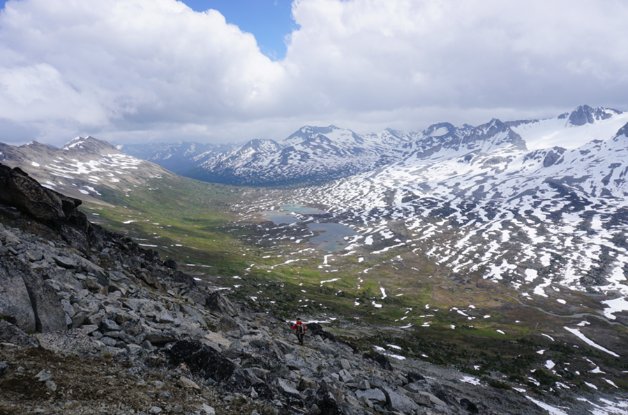
Despite the drizzle and the wind, this would be one of our last opportunities to do a longer day trip from camp and we wanted to head into the Sorcerer Group. The weather had actually been better the past two days, but oh well. We could see these peaks from camp and from every peak we had climbed, and they looked like a fun scramble.
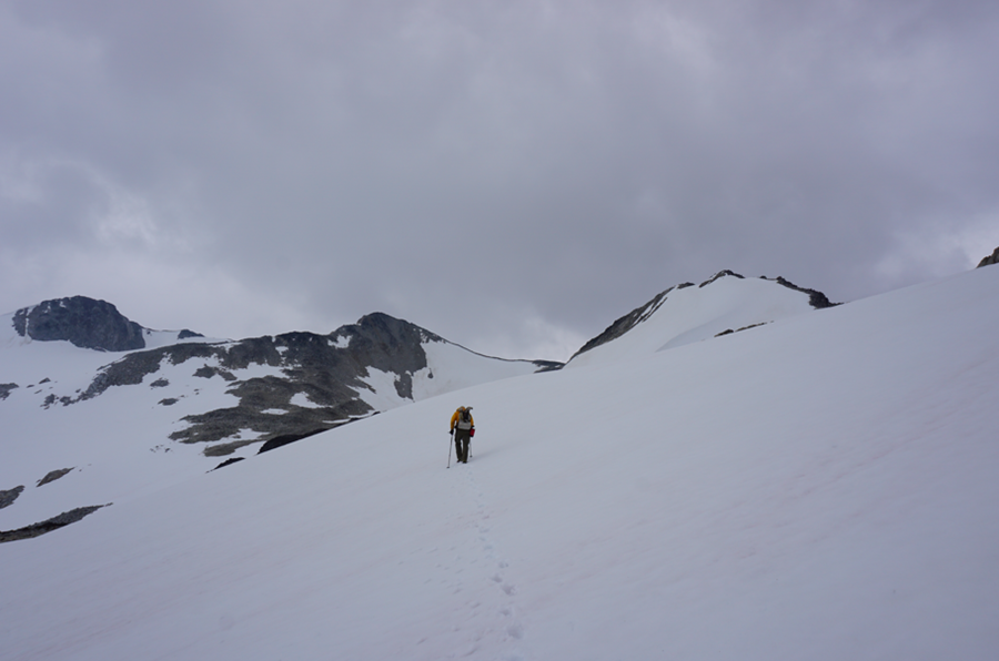
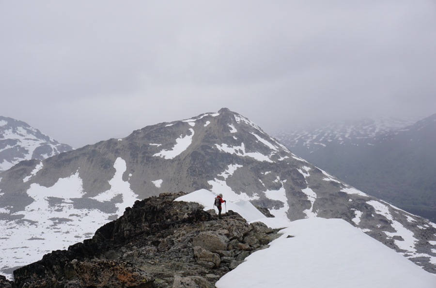
From camp we headed SW towards the western ridge of Stanza Peak. This peak is 3km west of Sorcerer Peak along a high ridge that we intended to follow. We climbed from nearly 2000m at our camp to about 2600m at the summit. The route was never more than class 3 and could have been easier if we had kept to the ridge the entire time. We elected to climb some steep snow as a shortcut. When we gained the ridge we were blasted by wind, to the point that either of us could barely keep our footing.
We tagged the summit and did not even stop – it was windy and cold. We dropped for about 15 minutes along the ridge and then stopped behind some rocks for shelter from the wind. Despite the air temperature, the wind chill was making us both very cold and we were happy we had packed the full Gore-Tex for the day.

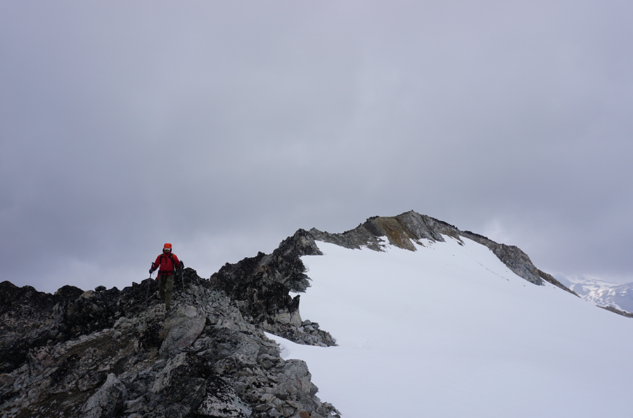
The ridge to Sorcerer Peak was longer than we thought and steep in places. There was always an easy bypass on the south side though. For a few minutes we were in complete whiteout as clouds rolled over the ridge and navigating the micro-terrain became difficult. We managed mostly to stick to the ridge though, and after a couple hours of work we were on the summit of Sorcerer Peak. The views to the valley to the south were epic and the entire area looked like fun to explore.

Again, we didn’t stop for long and continued towards Fantasia Peak. We left the ridge here and dropped down loose talus and some spring snow to gain the col with Fantasia Peak. The col is broad and flat and has a small lake. We stopped here for a few minutes – the sun was breaking through and we enjoyed some nice views.
We made the quick hike up Fantasia Peak for our third summit of the day. The clouds were back and it was raining lightly, so our stayed was short lived again. Instead of retracing our ascent route up snow on the south face, we stuck to the NW ridge and then traversed to the bowl north of Sorcerer. There were fresh grizzly tracks in the snow, but we could not see the family.
On the north side of Sorcerer, I left Dan to hike up an unnamed peak north of Sorcerer. It was very prominent from camp and I thought it would be a fun addition to the day – besides it was still early.
The wind blew and it rained harder, but I tagged the summit of the newly named Warlock Peak (to keep in theme with the area). There was a cairn up here already. Even through the cloud, I could see our camp and the gorgeous Slim Creek stretched out below me. It was a worthwhile detour, but I was cold and envious of Dan who would be getting close to home by now, so I packed up the day bag and headed back.
The way home was easy, but tedious as I switched between boulders, talus, snow, marsh, and heather. Numerous creeks had to be forded or hopped and by the time I got close to the tents I didn’t even bother with either and just waded through creeks.
Dan had collected water and we got dinner going. After dinner we settled in for a round of cards, hot drinks, and chocolate. It had been another great day of hiking in the Slim Creek drainage and we were excited to get one more day in tomorrow.
Day Seven: July 3, 2020 – Two Muskets
Distance: 10 km
Summits: Musket Peak, Musket SW2
This was our last full day at our basecamp. We had yet to explore any of the peaks to the north of camp (aside from the lowly bump of Mount Steve), and we decided to head in this direction.

The weather was still unsettled, but we started the day in great sunshine. After another healthy meal, we followed heather meadows until we reached the alpine area below Musket SW2. Here, snow, gravel, and boulders replaced heather and the travel became a bit more tedious. We picked our way up the loose south ridge of Musket Peak, aiming for the double summit.

Fresh snow on what looked like a tricky west ridge of Gun Mountain caused us to choose Musket as our main objective. The mellow nature of the trip was continuing until the end. Once we gained the ridge, the walking became easier on more solid rock. We were not sure which point was higher, so we hiked to both. A third summit to the NW looks almost as high.

The views of the immediate peaks were great, but the cloud ceiling had dropped and the larger peaks of the Coast Mountains were blocked from view. It was threatening to snow and we headed back down the ridge. The descent was much easier as we plunged our way down loose rock and soft snow.
At the base of Musket, we decided to skip Gun Peak and any of the other peaks to the north. We would head bag to camp, tagging the summit of Musket SW2 enroute. This is a lowly peak, but it is isolated and unique, rising abruptly from the surrounding plateau and offering almost 300m of prominence. It was another peak that was prominent from camp, and we were keen to stand atop it.
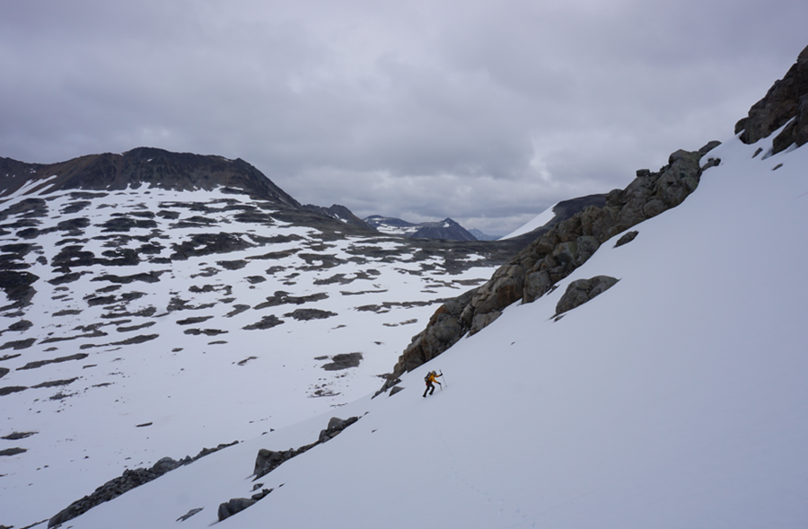
We climbed steep snow on the north face and it was one of the few times that we used the ice axes we had brought. Near the summit we gained rock and followed it easily to a large cairn. We could see camp from the peak and most of the other summits we had climbed. This was our eleventh peak of the trip and the last peak we would climb for over a year together!

The south face offered an easy descent back to the meadows above camp and we enjoyed the stroll back. The clouds were now quite low and the summit of Musket was no longer visible. Light rain and snow was falling, but we didn’t mind as we were only half hour from the tents.
Back at camp, we started a fire and sat under some bushes while we brewed tea and had a final dinner. More rummy and drinks brought the night to a close and we each crawled off to our solo tents.
Day Eight: July 4, 2020 – Back Home
Distance: 16km
Frustratingly, we woke on the last day to brilliantly clear skies. The weather was switching, and a lot of the next few weeks would see clear skies and hot temperatures. We were still pleased with the trip we had completed.
Although today was all downhill with lighter packs and a short distance, we were not looking forward to the kilometers of swamp, marsh, and bugs that awaited us in Slim Creek. We took our time at camp, lingering around and taking photos in the still morning air, before brewing up tea and eating the last of some extra food.

We broke down the firepit, filled in the poop pit, and brushed out the areas under the tents. It looked as it should: like we had never been there. Hard to imagine given the debauchery of the last seven days! We hefted our full bags for the first time in a week and grunted our way out of camp.
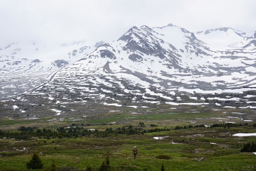
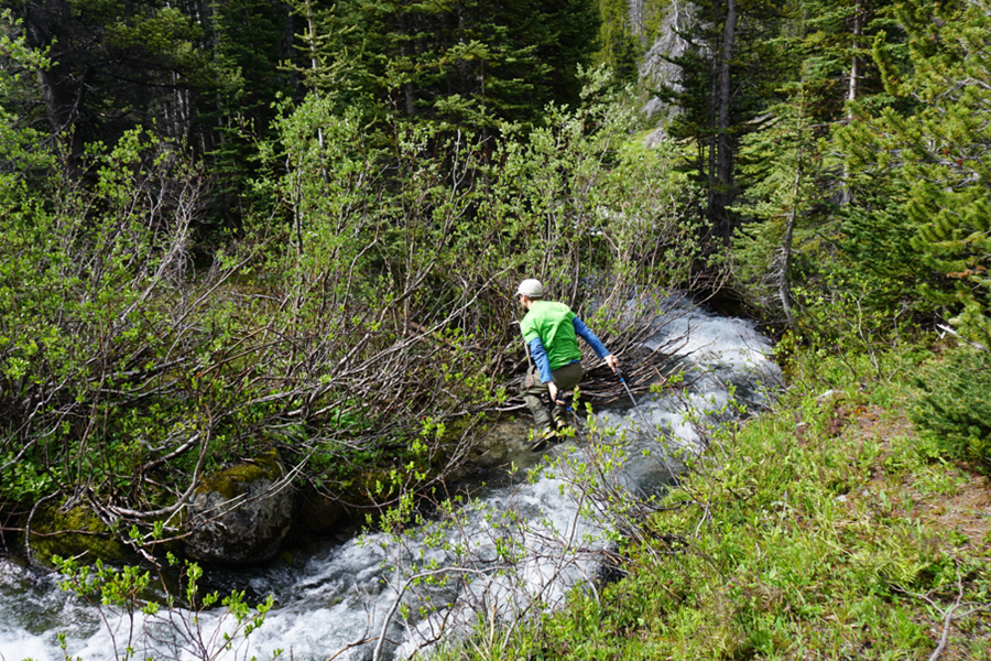
The scenery from the meadows below camp was amazing and we wandered through them, following the crystal clear Slim Creek as it grew from a trickle to a rushing torrent. We were less concerned with keeping our feet dry now that we were heading out, and within an hour we were both quite wet. The bugs were far worse on the way out than they had been a week before and we suffered profusely.
The way back was uneventful overall. We managed to cross “Not-Leckie” Creek in the same manner as before – by jumping across and then throwing the backpacks. We made it most of the way travelling quickly to avoid the bugs before hunger caught up with us and we devoured a bag of jerky and a few packs of Stinger gummies.

Back at the truck we celebrated with a cold beer and by getting out of our wet boots. We were tired, sweaty, sore, and beaten, but it had been a spectacular trip and we were happy to have pulled the trigger to go eight days ago. I have done more time in the mountains with Daniel than anyone – even Lindsay – and every time we go out is a great adventure.

Anthony, February 2022

One thought on “Slim Creek Headwaters Basecamp (Second Half)”