
First Half: Days 1 – 4
For four summers I have lived in and explored the Discovery Islands by kayak. Each year I have made plans to climb Mount Denman. I bailed from one solo attempt because I was afraid and forest fire smoke forced me to retreat from another. In 2020, my wife and I climbed Mount Addenbroke, but Denman still eluded me. This would be my last year living here and I was determined to climb Denman.

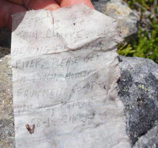
I thought it would be great to combine it with a traverse of the peaks to the south of Toba Inlet. Since reading about John Clarke’s exploits in the area, I have long wanted to ramble along the granite ridges of Toba.
As I was also very restricted in my time off in the summer, I figured flying in would allow us to explore more of the region. One of the only options in the alpine in this area to land a plane is Daniels Lake, and although the traverse from there to Mount Denman included a drop of nearly 900m in one section, it looked like a spectacular route with what promised to be stunning views and amazing terrain.
I recruited three friends, booked some time off work, and contracted a float plane pilot. With COVID disruptions, a wedding to plan, and busy friends, I began planning in March and was truly amazed when everything ended up working out – including a heat wave that melted Daniels Lake just days before we were set to fly in.
Stats & Route Map
Participants: Andrew, Ben, Daniel, Anthony
Dates: July 8 – 15, 2021 (8 days)
Distance: 104 km (GPS)
Ascent: ~ 9715 m (GPS)
Peaks: 18

Day One: July 8, 2021 – The Boulder Camp
L and I live during the summers on a remote boat access only island in the Discovery Islands. There is no cell phone service and trying to coordinate three friends to meet on a floatplane was difficult. After a hectic day of last-minute boats rides and isobutane fuel runs, I woke early on July 8th to brilliant sunshine.
It was two days after my 30th birthday and in the last 40 nights I had spent 35 of them in a tent. I was exhausted already and I felt old. But, I was beyond stoked to be getting into the mountains with good friends. L dropped me off at the public dock at Surge Narrows. I was early and tried to nap, but ended up sitting around anxiously waiting for the plane.

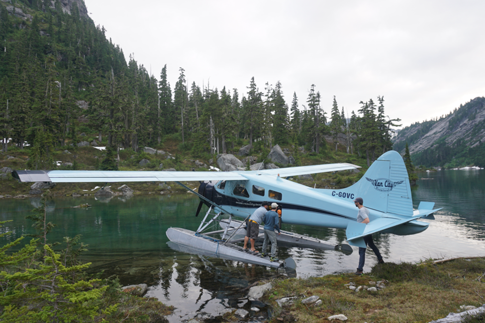
I heard the drone of the floatplane long before I saw Peter from VanCity Seaplanes drop into Surge Narrows and tie up to the dock. Peter was the only pilot of the many that I contacted that agreed to fly into Daniels Lake. He was in a perpetual rush and I climbed aboard and we took off abruptly. As soon as we cleared the trees my heart sank, as I saw low, thick cloud hanging over the Coast Mountains. It had been brilliant sunshine from my perspective and I didn’t have cell phone service to check the weather. Peter didn’t look optimistic. This is always a problem planning floatplane trips 5 months out!
Peter showed his true hand though – as an extremely skilled pilot – as he dodged through clouds to follow the Daniels River valley to within 1 km of the lake. Dense fog and cloud sat low and clung to the vertical walls and there was no safe way through. Peter turned back and we agreed to be dropped on Cortes Island where we could reassess our plans.
We hopped off on the dock and piled our gear in the sand. It was sunny and hot and we embraced the local spirit and spent a hazy day enjoying the beach and good food. In the evening Peter was finally available and we confirmed the clouds had burned off. He picked us up and we had an amazing flight over Desolation Sound and into the Daniels Valley.
The approach to the lake was absolutely stunning in the evening light.
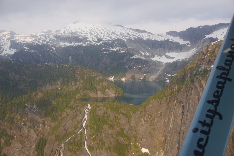
The sun was sitting low as we landed at the lake and we unloaded our gear quickly. Peter took off and we were left alone – always one of my favourite moments on an expedition. Our only objective for the evening was to gain the ridge and set up camp before it got too dark. Clouds were thin, but were still covering most of the large peaks and the light was gloomy and grey.
We headed east along the shore of the lake travelling easily through sub-alpine forest and heather meadows. Waterfalls cascaded around us and after some time there was gorgeous light on the lake, but we ignored all that and hastened uphill, towards the ridge.

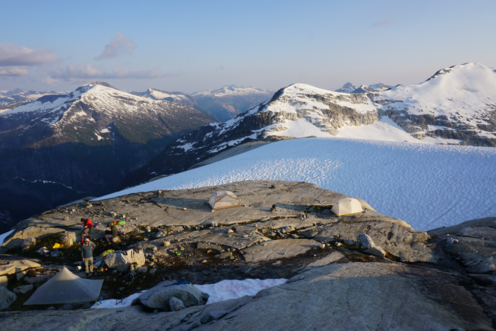
After a quick 500m climb we felt well acquainted with our heavy packs and quickly found a place to ditch them and set up camp. It was nearly dark when we pitched the tents in a cluster of truck-sized boulders. It would be our worst campsite of the trip, but we didn’t know that at the time and enjoyed it none the less.
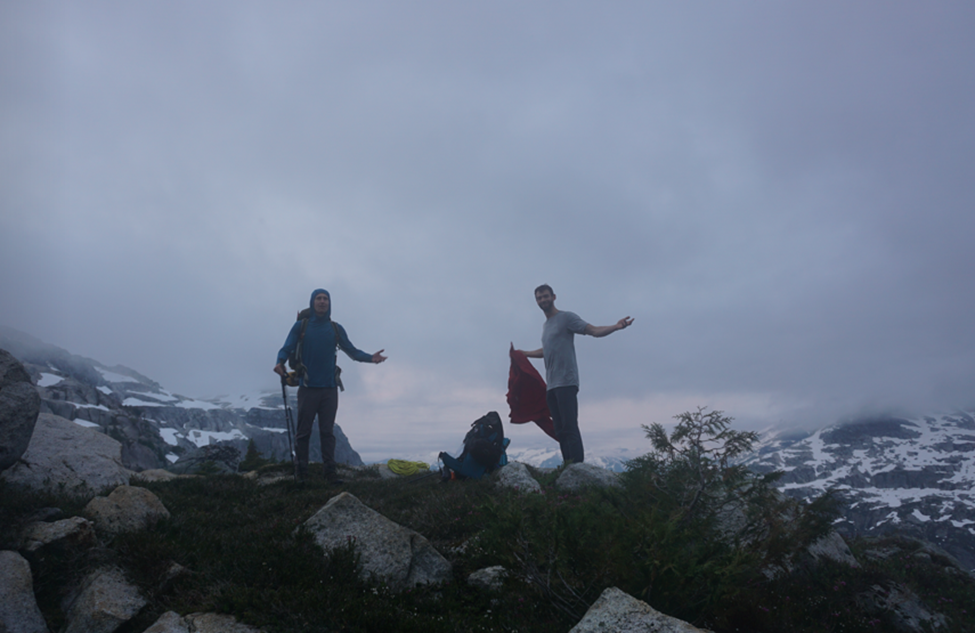
Dan and I opted for lightweight solo tents, while Ben and Andrew shared a two-man tent. We enjoyed some good food and wandered back to the tents, where sleep came quite quickly. We were stoked with the forecast of 7 days of sun and were excited for the views that the morning held.
Day Two: July 9, 2021 – The Flat Rock Camp
Summits: Cando Peak, Boulder Hub Peak, Chusan Peak
We had decided the evening before to stick to our plans of climbing Cando Peak, Julian Peak, and Brighton Peak before beginning our push back west to Homfray Channel. When we woke in the morning, fog and low cloud lingered over the high peaks, but the sun was already scorching, and we were confident it would burn off the clouds.
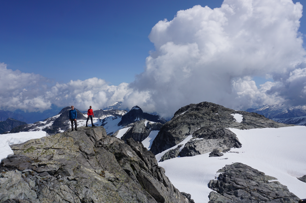
After a hearty breakfast, some tea and lazing around, the clouds mostly cleared and we headed out for Cando Peak. This peak lies to the southeast of Daniels Lake. It was prominent from our campsite and looked like a fun peak to climb with great views.

We decided the best approach was to follow the obvious ridge route to the summit. This proved to be fairly straightforward, although our route encountered one section of class 4. I think with better route finding one could avoid this, but we were having fun. The granite in this area is incredibly grippy and the hiking and scrambling was great fun.

Our ascent up the ridge was quick and it was still early in the day when we reached the summit. Some clouds still lingered on the summit and our views were limited. But we were able to see a lot of our route for the next few days and had our first of countless views down Daniels Valley.
After indulging ourselves on the summit, we dropped onto the north face that we could see from camp. The travel on the glacier was straightforward without crampons, and we easily plunged through soft sun-warmed snow. A tricky band of granite gave us pause before we were able to regain the flats under the ridge and hike easily back to our camp.

We were at the end of a massive heat dome in BC and the temperature was already in the 30s. We found water and rested in the shade of our boulder camp before packing up and moving on. After a lazy morning and already feeling zapped from the heat of the day and our late night, we decided to forgo Brighton until the following day, move our camp to a better position, and head out towards Julian and Chusan Peaks.
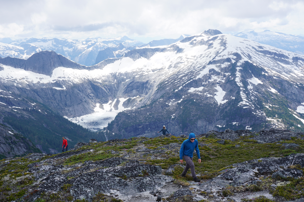
We walked the thirty minutes towards Boulder Hub Peak, where we found an incredibly flat rock to make camp. The site came with running water, sitting rocks, and a top-notch view. It was only a taste of some of the amazing camping to come. After dumping our gear, we continued over BH Peak and on towards Julian & Chusan Peak.
To get to Chusan, we had to lose a bit of elevation but the terrain was straightforward and the route was simple. We enjoyed our first glimpses of the inlet and some spectacular walls just to the south. It was easy hiking and a great easy first day in the area. We decided it was too late in the day to push all the way to Julian, so we were in no rush and enjoyed the views from Chusan before hunger called us back to camp. The return was equally uneventful but enjoyable and we were back to our flat boulder to relax for the afternoon.

Dripping with sweat, we washed off in the fresh meltwater and devoured some snacks. All of us had brought substantial food rations and we were enjoying a proper amount of calories – at least at this point in the trip. An awesome sunset kept us up into the twilight hours, but we set the alarms early to head out the following day to tackle Brighton Peak – the highpoint of our trip.
Day Three: July 10, 2021 – The Tarn Camp
Summits: Cluney Peak, Nolan Peak, Brighton Peak (Brighton NE0), Bremmer Peak
Our Flat Rock Camp proved to be a great site to spend the night and we woke refreshed and ready to go for the day. Tea was brewed, breakfast was made, bags were packed and we were ready to head off towards Brighton Peak. We stuffed all our food and gear under some boulders in the shade and made our third ascent of Boulder Hub Peak.
We retraced our route towards Chusan Peak, but after a few hundred meters we dropped off the ridge, heading south and losing elevation towards “Brighton Lake”, the lake just below Boulder Hub Peak. We were aiming for the col between the Brighton massif and BH Peak. This is one of the more technical sections along the North Powell Divide and we thought that we might need the rope here.
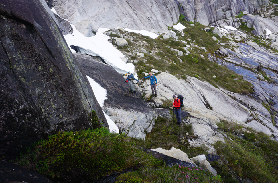
With our day packs and the early summer snowpack though, we were able to make our way to the col with only minor issues. We took a break in the shade, ditched the rope, and then started climbing SE along the ridge to Cluney and Nolan Peaks.
One steep patch of snow guarded entrance to the ridge. It was north facing and icy. We kicked steps all the way up but never took out the ice axes we had bothered to drag with us. Dan later reflected this was the most dangerous part of the trip for him and he was a little peeved we hadn’t discussed it. None the less, we continued on, enjoying the increasingly good views
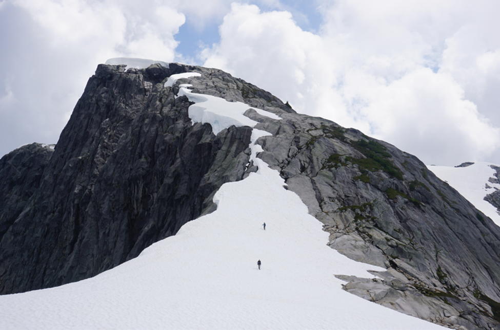
The rest of the morning was quite straightforward as we rambled our way towards Brighton Peak. We skipped Cluney Peak on the way, but it is necessary to go right over Nolan Peak, so we bagged it enroute.
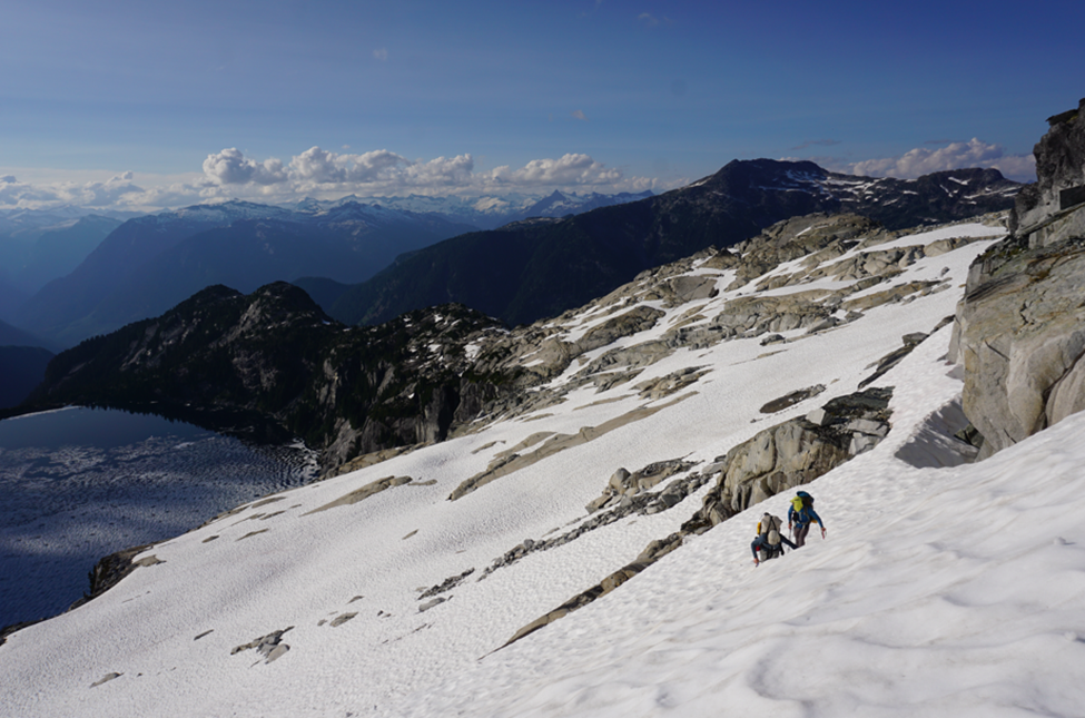
After taking a short rest on Nolan Peak, we lost a bit of elevation and found ourselves at the base of the NW face of Brighton Peak. We stopped here to check out the route. The recent heat had melted a lot of snow, but the glacier still had decent coverage. We had left our rope at the col and Ben discovered he had forgotten his crampons. We elected to do a large switchback across the glacier, avoiding the main crevasse on the face, but when Daniel, Andrew, and I looked up from putting on our crampons, Ben was charging a line straight through up the face.
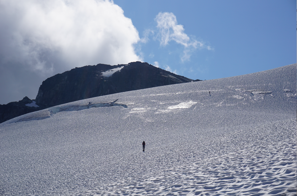
The snow turned out to be soft and supportive and crampons were unnecessary. Like the rope, they would enjoy a free ride to Homfray Channel without being used again. We all regrouped at the col between the two peaks and went up the small bump that is Brighton NE0. The views from here were fantastic, as they often are from subpeaks.
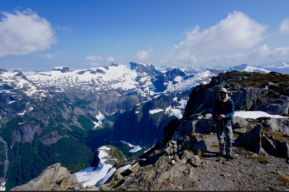
We had a long day ahead still and only spent a few minutes on the peak before returning to the col. We grabbed water bottled and ice axes and climbed some steep snow to the summit of Brighton Peak. This was the highpoint of our trip. Thousands of Coast Mountain peaks and islands spread out before us. It was a splendid place to spend some time.
We descended to our bags at the col, tried to satisfy our continual hunger, and then booted our way back down the glacier. The return along the ridge was uneventful, but we did take a few minutes to scramble up Cluney Peak from some more views of Daniels Lake.
Back at the col above Brighton Lake, we almost forgot the rope, but Andrew had a feeling his bag was too light. We reversed our moves across the slabs and back to BH Peak for the fourth time. We split up here and I ended up in camp a bit before everyone else. I destroyed some Oreo’s and potato chips and then we all sat around trying to get as much water into our bodies as possible.
Slowly we started packing up. The weather was amazing, but the heat was zapping our energy. We traversed from camp below BH Peak, avoiding climbing it for the fifth time. We crossed some amazingly flat slabs and awesome tarn country on the broad ridge to Bremmer Peak (Chusan SW3). This peak was easily hiked up. It offered astounding views of Daniels Lake and some great beta on the next part of our route.


Our original plan had been to go up and over Tinghai Peak (the next bump on the ridge), but the ridge looked tricky and we saw continuous snow on the north side that looked like an easy alternative. We decided to traverse below the summit. This was a great decision as we were tired and the terrain on the ridge would have been difficult with the heavy bags. We made quick time on the traverse and remerged on the ridge just to the west of Tinghai Peak.
It had been a long day in the sun and stopping to camp was top on our mind. We didn’t have to spend long on the ridge when we stumbled upon a ridiculously prime campsite and the top one of the trip. A subalpine tarn surrounded by soft moss, running water, large boulders, with flat spots for tents and an area to eat – all complimented by some of the most dramatic views of the Daniels Valley that we had seen the entire time.

We each took some time to find the perfect spot for our tents and get prepared for the evening. After settling-in, we gathered for another night of cooking, drinking, and relaxing. It had been a great day and it felt good to finally be making some forward progress on our route west, towards Homfray Channel.

Day Four: July 11, 2021 – The Ridge Camp
Summits: Tinghai Peak, Flipper Peak, Endspur Peak
As usual I woke earlier than we planned. This time though Ben and Andrew joined me as they got ready to hike up Tinghai Peak. They wanted to catch the sunrise from the summit. I would hike up with Daniel in a little bit. Ben and Andrew left and I set about making some tea and breakfast until Dan woke up.

We set off for the minimal elevation gain to the summit just as Ben and Andrew were returning. They settled into breakfast and coffee while we scrambled up mellow terrain to Tinghai Peak. There was not a cloud in the sky and the views were phenomenal. Our route to the ocean stretched out before us. We made quick work of the return and were soon back at the tarn breaking down our camp.

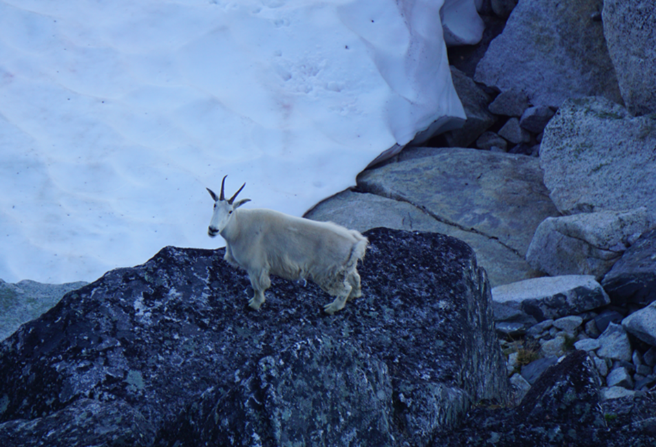
The entire way to Flipper Peak, the ridge offered tremendous views of the Daniels Valley and Lake and the peaks to the north of Toba Inlet. This was a stunning morning with amazing visibility. We left camp with high energy and hiked down the narrow ridge towards Flipper Peak. The ridge broadened after a few hundred meters and we enjoyed an easy stroll to the summit of Flipper. We saw one of the few mountain goats that we would see on the trip.
After stopping for snacks and water on the summit of Flipper and enjoying the views, we continued our leisurely stroll along the ridge towards Endspur Peak, which dominated the skyline. A few kilometers west of the summit of Flipper, the ridge splits and we took the south fork. The ridge up until this point was broad and the walking was easy. Countless tarns and stunning views of the Daniels Valley and Toba Inlet kept us moving at a slower pace – we also knew what was waiting for us in a few hours time!

After heading south on the ridge for a few hundred meters, we traversed across the small bowl on Endspur’s NW face and dropped our packs on the west ridge. Another water break to beat the heat and then we climbed the last hundred or so meters to the summit. We were surprised to find a summit register here with some well-known names and ambitious trips. These would be some of our finest views of the Daniels Valley and our last views of Daniels Lake. We lingered on the summit – all dreading the next section of the trip.

When I planned the trip back in March, I knew this section would be brutal, but never figured that it would be 35degC outside. I hadn’t done a proper coastal bushwhack in a few years, so I think I just forgot how heinous they can be. Daniel is a legend in the trees and we settled into a single file line, following our leader over bluffs and through dense bush, dropping nearly 1000m to just below 900m above sea level. We were following the age-old adage of “if it grows, it goes.”

We crossed beneath the powerlines that originate at the Montrose Creek and East Toba Power Plants and headed north, dropping slightly down the valley. Dan was leading us to the correct gully he had mapped out. Halfway up we lost faith though as we ended up high on some steep bluffs. Here for the first significant amount of time our group split.
At this point, Andrew and Ben were committed to the bluffs and climbed low class 5 to gain the sub-alpine. Dan and I tarzanned our way along the edge of the bluffs until we were able to regain trees and finally meet Ben and Andrew in the sub-alpine forest. We arrived at nearly the same time and were exhausted, sweaty, dirty, and hungry. I think Dan was secretly happy to have spent so much time in the bush though.
We climbed a few hundred more meters to the first flat spot on the ridge and dropped the bags. We had descended and regained 900m of elevation through bush and over bluffs, in blazing heat, with 35lb bags in just 4 hours. Pretty decent.

We had amazing views of Toba Inlet from camp and after hot drinks and dinner, we sat and enjoyed the sun setting over the inlet. The crux of the first part of our trip was behind us now. Our second crux – Mount Denman – still loomed on the horizon, but instead of dreading it, we were all looking forward to it.

To read part two click here.

Hi, a friend of mine just sent me a link to your site. This is excellent and great to see people who get out. My friend Mark and I kayaked up Toba 2 years ago, stashed the boats and hiked from the head of Toba up Mt Julian then southward and came out at the Edelred climber’s camp. I’ve also been up Denman from Forbes Creek and made one failed attempt at Addenbrooke so far. Anyway, I’m Ken, I live in Powell River. Happy to buy you a beer and look at maps anytime.
LikeLike
Hi Ken, thanks for reaching out! Awesome to hear you bushwhacking up from the inlet – that is the way to do it, but due to my work as a kayak guide, my time off is very limited in the summers, so we made the decision to fly. Kayak approaches are my preference though – my wife and I will hopefully attempt Estero Peak – a bit further north near the entrance to Bute, but another coastal giant. Addenbroke was a great climb – I am not sure if you saw the report we wrote for that one. Would love to connect sometime for sure – we are attempting to kayak the Northwest Passage over the next three summers, so I am a bit tied up, but I will reach out next time I am in your neck of the woods.
LikeLike
Hi Anthony!! This website is exactly what I’ve been searching the internet for! I’m from Read Island, and I’m planning a big sailing and mountaineering trip this spring! I was originally planning to go up the bute I let into the coastal mountains up there, but after reading this blog I’m so stoked about this route! I was wondering if you could give me any more specifics and details about it (I can’t find any of the peaks or lakes on Google maps). It looks like an incredible adventure! Thanks! If you happen to see this pretty please email me back thank you!!!
-Ella
LikeLike