Not so much of a trip report as it is an endorsement for the Mamquam River valley.
I’m sure many are familiar with the great access to the alpine that the Mamquam FSR offers, but I will share the trips I have done this year with hopes to inspire others to explore the area.
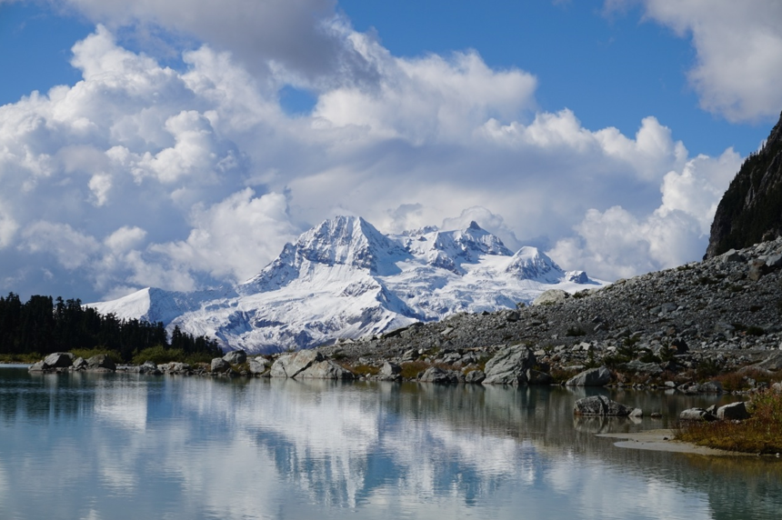
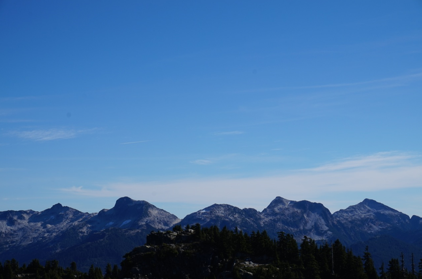
While the Mamquam Valley itself is nearly completely logged out, the sub-alpine and alpine areas are rarely visited and worthy of attention. Each peak offers views of the local North Shore Mountains, the glaciated peaks further north and west, and the high-divide of the Coquitlam-Pitt. There are gentle ridges, steep scrambles, technical routes, or easy hikes. I saw goats twice in the valley this year – the closest I have seen them to Vancouver yet, once at Knothole Lake and once near Gillespie’s summit – despite multiple visits I did not find the fabled Darling Ridge salt lick.
I just want to thank the efforts of the BCMC (in particular with regards to Watersprite and Darling lakes access), contributors on ClubTread and bivouac, and all the effort that individuals put in to maintaining and constructing trails and points of access – without you, these trips would be much more difficult, hopefully I can add a bit of help as well.
………………………………………………………………………………………………………………
These trips span from Spring to Fall 2015, with climbing peaks being the main objective, and were completed largely with my girlfriend, but also as solo ventures. If one is more inclined to hike rather than scramble, the area is a wonderland of subalpine lakes and ridges.
I will only give a brief description of each trip and let the photos do the talking.
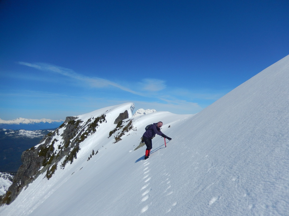
April 18-19, 2015
Watersprite Lake and Dreadnought (Crawford W2) Peak
Access: Skookum Dam Road, KM ~13 on Mamquam FSR, LC 4×4
Peaks: Dreadnought
Our first trip into the area was a visit to Watersprite Lake, with no plans but to get there and decide on the go.
With low snow we reached the lake in just under four hours. Conditions were less than ideal as the boulder crossings were half covered and the snow was isothermic.
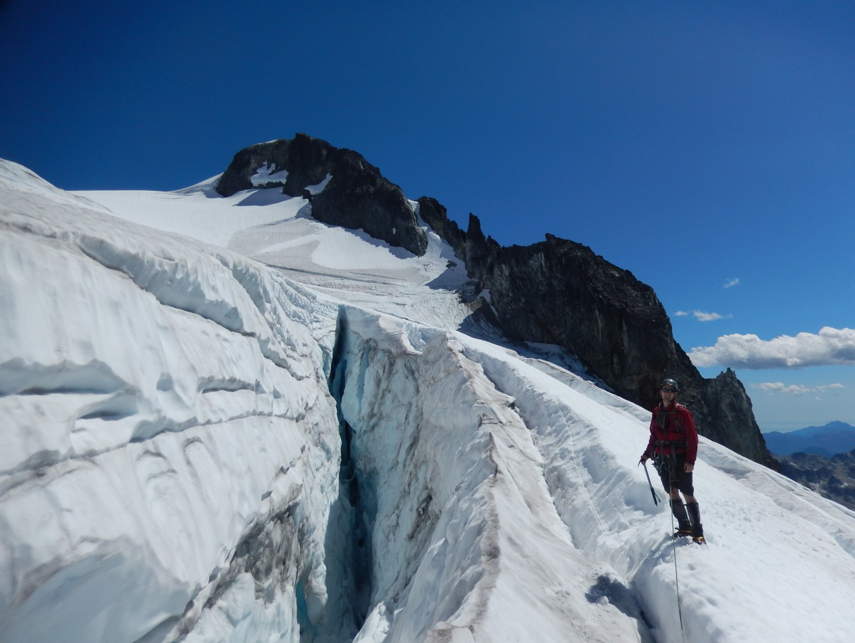
The lake was still frozen and we crossed it and set up camp on the slopes of Dreadnoughts west ridge. The following day we climbed terrible snow to gain the ridge and then followed it to the summit. A steep traverse was required below the summit and a massive cornice was atop the peak. As with most peaks in this area, the views were awesome towards Mamquam and out over the SW summits and Pinecone Burke.
We descended down the same route to camp and rambled out to the truck. Our first experience in the Mamquam was a good one and I was eager for more.


May 9-10, 2015
Knothole Lake and Pinecone Peak
Access: Mamquam Main to KM~22, overgrown spur, LC 4×4 (NOT RECOMMENDED)
Peaks: Pinecone Peak
This would be my first solo trip into the area and my first visit to Pinecone-Burke.
I followed Bivouac instructions for the “Knothole Lake Trail” with the last update on conditions being 2010. I recommend never going this way in without a substantial snowfall. I’m not too sure why I continued on the road, but the second growth was unpleasant as well. Needless to say, by the time I reached Knothole Lake, I was already running low on energy. The temperature was warm and the snow was once again terrible. I sat at camp for a bit, watching goats on the slopes of Pinecone Peak and then set off for Seed – I ran out of steam on its 1900m subpeak with good views all around.
The next morning I was up early and reached the summit of Pinecone view some steep snow and awesome ridge walking within an hour from the lake. The early morning views were awesome and the summit register contained some memorable names.
I descended back to camp and needed to be back for dinner, so headed directly back to the valley.


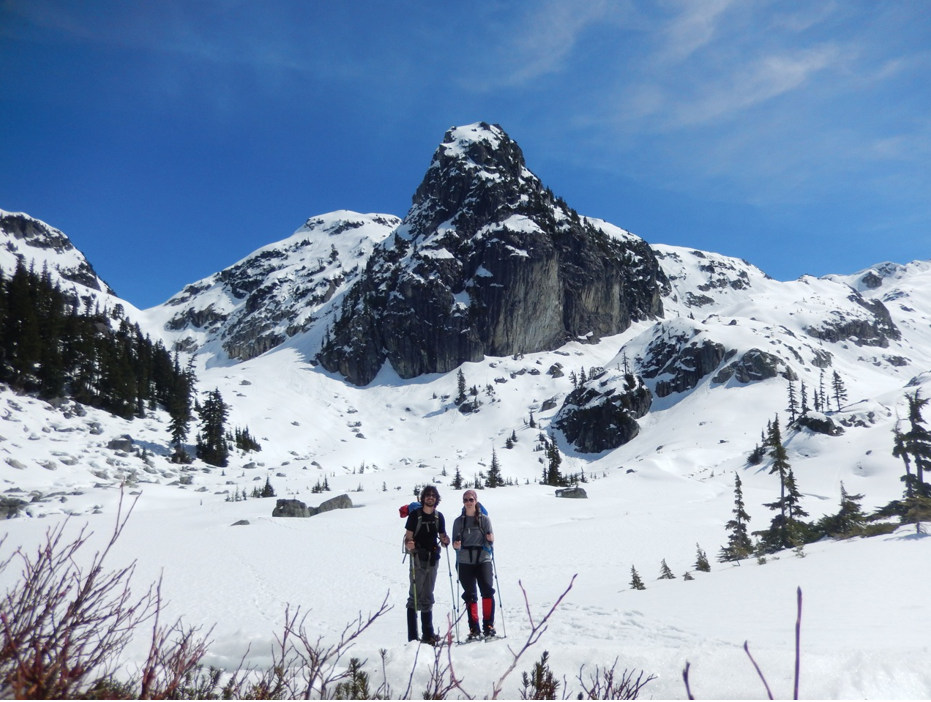
June 25-27, 2015
Watersprite Lake and Mamquam SW Summits
Access: Skookum Dam Road, KM ~13 on Mamquam FSR, LC 4×4
Peaks: Watersprite Tower, Gibson Peak, Martin Peak, Dreadnought Peak, Crawford Mountain, Paranoid Peak, Epiphone Peak, Fender Peak, Washburn Peak
This trip is reported in more detail on Bivouac (Mamquam SW Explorations).
I trudged up the road after being dropped off on the Mamquam River as my driver was already late for work. Reaching the lake, I set up camp and set out for the first day. I climbed Watersprite Tower via an easy gully from the lake and some 4th class scrambling near the summit. Then I followed the ridge over Gibson and Martin Peaks and returned to my camp at the lake. Great views were had from all peaks with pleasant scrambling and ridge walking. The only difficulty I encountered was descending Gibson enroute to Martin.
The following day I set out for my main objectives: Bucklin and Crawford. I also wanted to summit Dreadnought without snow and decided to descend the east face enroute to Crawford. This descent is steep and perhaps low 5th – it cost me time and ultimately I never made it to Bucklin.
From the eastern ridge of Dreadnought, I headed east up Crawford and then turned north and descended to the pass of Bucklin Valley and Paranoid Creek. I ascended steep, loose snow and scree to the ridge of Paranoid Peak and then 3rd class to the summit up heather and rocks steps.
I returned the way I came, but avoided Dreadnought and opted for the Watersprite Tower-Dreadnought col, which proved to be quite easy. There are massive boulders in the broad bowl leading to this pass from Watersprite Lake.
On the third day I headed to a highpoint on the Gibson ridge (Epiphone Peak) and then south to the peaks south of Martin Lake (Fender and Washburn). I ascended each easily (and retrieved SimonC’s rope on Fender) and have apparently been credited with a first ascent of Washburn Peak on Bivouac. While there may be none recorded and was no cairn, I think such a low elevation peak (seen directly from Squamish) has been ascended many times. Logging roads (overgrown now) run up to nearly 1200 m on the southern slopes of both peaks.
I returned via “Upper Martin Lake” and Martin Lake and enjoyed a beer at the lake with a fellow camper.
The next day was a rapid descent to the trailhead – my comrade offered me a ride and saved me the 16 km walk to the highway.


July 18, 2015
Sky Pilot via Stawamus-Indian FSR
Access: Mamquam FSR to KM ~4, Stawamus-Indian FSR, and Shannon Creek Road, HC 4×4
Peaks: Skypilot Mountain
We climbed Sky Pilot via the standard route, cheating by driving to the top of the gondola. I will not elaborate as this trip has been reported on in-depth.
July 29, 2015
Mamquam Attempt #1 – Delusion Peak
Access: Skookum Dam Road, KM ~13 on Mamquam FSR, follow till end at headpond, HC 4×4
Peaks: Delusion Peak
My climbing partner Andrew had been wanting to get into the alpine. He had a buddy visiting who had never climbed a coastal mountain. I had plans to head out to Cayley, but when they weren’t too keen on that, I suggested Mamquam, knowing the access was prime right now.
We arrived late-ish at the trailhead and reached the lake by perhaps 11. We encountered a fast, lone hiker enroute, aiming for the newly named Manic Peak – I summized correctly that this was Simon. I thanked him for the rope and we parted ways near the lake.
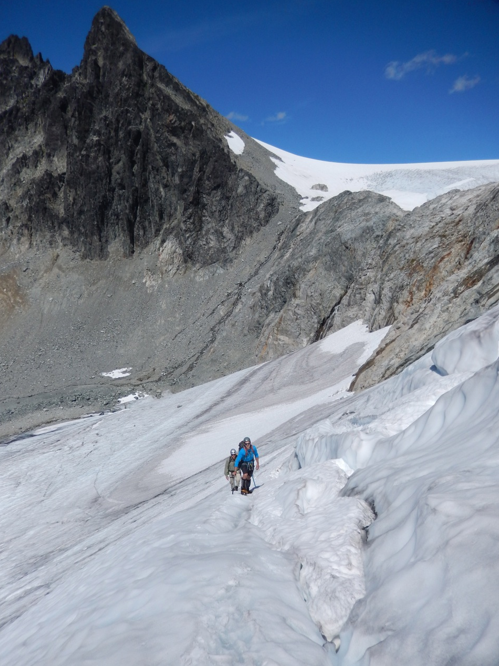
I eyed the route to the SW glacier, but were not sure if it would go through, so with the little knowledge I had, I suggested the ‘regular’ route. We headed to ‘Upper Darling Lake’ and then gained the icefield. This was our main error. We gained it too early, too far south of the pass between Delusion and Darling, where it is gentler. Crevasses turned us around, and we decided to return around 2PM via the correct route.
However, upon reaching the pass, we decided to see how far we could get and reached the summit of Delusion via the SW skyline ridge, a nice airy 4th class scramble, at 4PM. Upon seeing the SW glacier holding more snow and looking like a better alternative, we decided to return this way, and found easy passage on and off the glacier and down scree and snow to the lake. This has now become the standard from Darling Lake, with an ascent of Mamquam via the south slopes. It is much more direct than the previous route.
We reached the truck around 10PM after getting turned around a bit on logging roads (“Was that bench there on the way up?!”).


August 15-16, 2015
Seed and Gillespie
Access: Mamquam FSR KM ~26.6, Mamquam E100, HC 4×4 (Heavy washouts on multiple creeks along Mamquam this far out)
Peaks: Seed Peak, Gillespie Mountain
One of my favourite trips of the year.
Being smart, I decided I would instinctively know the road when we happened upon it. I didn’t. We drove to the end of the Mamquam FSR and up the Dunkeld spur. We briefly considered changing plans, but then drove back to the correct road and parked shortly thereafter on the E100, stopped by a washout we probably could have driven.
Despite low clouds and rain, we pushed onto a tarn just west of Seed and Gillespie basin. Here we set up camp in the mist.
Upon waking at 6AM, we were surrounded by cloud and went back to sleep. By 7, the ceiling was dropping and we were perhaps 25m above the clouds, with the high peaks sticking out. A magical morning with awesome glimpses of Meslilloet.
We followed the ridge northeast to Seed Peak (as per the 103 hikes). The summit offers great views of the lakes, and the clouds still shrouded the Pitt River. We descended the summit and continued south along the ridge to Mount Gillespie.
The final ridge is an easy class 2 scramble and we saw goats on the ascent. There is an old sign up here and cement foundation – remnants of a more accessible time!
We returned via the glacier and low point on the ridge, meeting a party out for a day trip who ran out of time on Gillespie’s slopes. They gave us a ride back to our truck as they were able to negotiate the washout. (We got a flat on the way out – first of the year!).


September 4-6, 2015
Darling Lake and Mamquam Mountain
Access: Skookum Dam Road, KM ~13 on Mamquam FSR, follow till end at headpond, HC 4×4
Peaks: Manic Peak, Mamquam Mountain
Two days earlier we were going stir crazy in our tiny2-person tent after three days on a ridge above Icemantle creek. Two years and two abandoned attempts at Mt Pitt. “The mountaineer intends, but the weather decides” words to live by I guess.
Anyhow, we salvaged our vacation time with a three day venture into Darling Lake.
On the first day, we hiked in and discovered the flagging to be removed, but I knew the route from my last visit. We reached the lake and set up camp. I climbed the small bump to the south, now labeled Manic Peak on Bivouac. It offered good views into the area I explored in June and of Darling Lake and Peak.
On the second day, we set out for Mamquam via the SW glacier route. A fresh dusting of snow covered the glacier and upper ridge and things were nice and slippery. Just as we reached the snow bench and base of the southern ridge, a cloud rolled in and sat on the summit – the temperature plummeted and visibility was gone. My girlfriend elected to wait near the base of the ridge proper, while I continued on. Despite the lack of views, getting turned down twice when so close was not something I was too keen on. I am still waiting for a view down to the mouth of the Pitt River though!
We returned across the glacier and spent the afternoon watching clouds roll across Garibaldi and playing with a new camera trying to catch the Dipper’s in the lake.
The third day we hiked out and met a group camped in the forest below the ridge – they ran out of time the day before. We also ran into Stoked on the trail section and had a good conversation regarding the future of the trail and bridge. (Unfortunate how things ended up, but thanks again to all BCMC for the work!).


October 14, 2015
Alpen Peak and Split Peak
Access: Mamquam FSR to KM~9.5, “Alpen spur” (quite a lot of spurs near top),HC 4×4
Peaks: Alpen Mountain, Split Peak (Alpen N1)
This trip could also be called “Lost in A Maze of Logging Roads”. On my first attempt I got turned around on the multiple spurs and bushwacked around for a while then did some more driving until I had an idea of the roads. I happened to run into a guy flagging out new cutblocks – this area will soon be re-opened for logging and there is heavy flagging on the drive up.
On my return, I knew where to go and drove to within one km of where I wanted to join the old growth. I followed old growth over the sub summit and gained the main peak within an 1.5 hours after leaving the truck. The views were great, especially towards the Sky Pilot region. I reached Split Peak (1km south) and played around a bit in the technical cracks and massive splits, the views of Sky Pilot and Mountain Lakes area improved continually.
I returned the same route for an easy half day out and my last snow-free outing of the year.


November 15, 2015
Anif Peak
Access: Mamquam FSR to KM~7, “Mulligan spur” , HC 4×4
Peaks: Anif Peak
Looking for a short snowshoe to start out our winter season, we opted for Anif Peak and Mulligan. We managed to drive to about 800 meters before being stopped by snow.
The postholing in snowshoes began. From this point, it took us around 4 hours to reach the summit of Anif, with no views in any direction. The steep snow steps along the ridge were fun, but the snow condition was not. The final ridge itself was a pleasant stroll, surely more dramatic with more snow.
We decided to skip Mulligan due to worsening weather and called it a day, returning the same way in about a quarter of the time, with plenty of sliding.
A good way to end the year here – I think this is it, maybe a snowshoe to Watersprite and Dreadnought W1.

………………………………………………………………………………………………………………
If you have any questions regarding access or route information shoot me a question, but most of it has been covered either on this site or Bivouac.
Regrettably I did not have the time or money to complete all my intended trips in the area and have missed many of the larger peaks in the southern part of the Mamquam – I intend to enchain them in a traverse next year from Coquitlam Mtn to Mamquam via Cotard and Bucklin Peaks (PM me if you have two free weeks in May).

Thanks Anthony. I’ve climbed all the Mamquam peaks (twice), so if you need any help let me know.
LikeLike