
Kingcome Inlet modern pictographs – worth the paddle!
In May 2021, after several cancelled plans due to COVID, I married the love of my life on a dock on north Quadra Island. What could be better?!
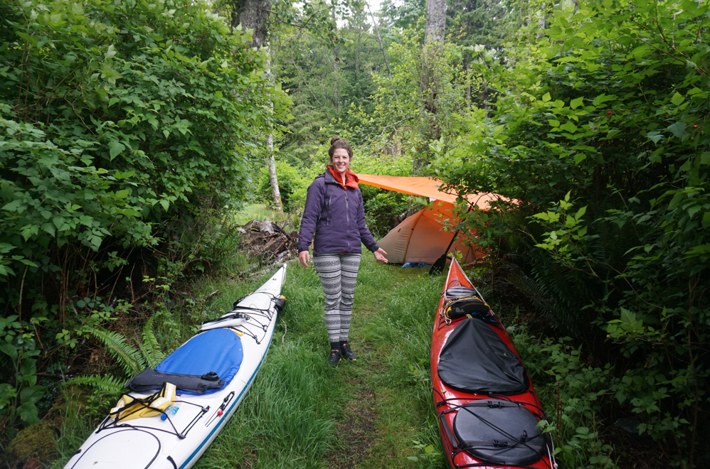
The following afternoon we left on a 24-day kayaking honeymoon expedition. As with many things during the time of COVID, this was a plan B expedition, but still one that had been on our minds for some time. Despite the lingering smells and sights of progress, the Discovery and Thurlow Islands offer supreme solitude and the shoulder season in the Broughtons never disappoints.
We paddled around 650km over 24 days, averaging around 31km for the days we paddled. Despite having a GPS all of our navigation is done using paper charts, so distances are never completely accurate.

Trip route in blue – linking previous trips we have done in green (Discovery Islands), red (Central Coast & Cape Scott), and yellow (Broughtons).
Although the route and conditions allowed us to paddle every day, we elected to take three rest days. The first on Yorke Island because we wanted to sleep, explore the ruins, and eat crab; the second in the Burdwood group because, well…it’s the Burdwood!; and the third at a friend’s float house in Pott’s Lagoon.
Campsites for the trip were largely sourced from the familiar places: BCMTN and their fantastic map (which has been recently upgraded); the John Kimantis books, which despite being nearly 20 years old offer a lot of hidden gems; West Coast Paddler Trip Reports – in particular those by Phil Torrens (who may remember me texting him from Yorke wondering how I missed a certain pictograph); and just good-old charts and satellite images.
Check out “The Rock Art of the Northwest Coast” by Doris Lundy (available online) if you are interested in First Nations rock art sites. There is no better resource available to the public.
This trip includes 10 tidal rapids, 3 big trees, 2 semi-sane sea kayaking enthusiasts, & 1 portage. I highly recommend it.
Part 1: North Quadra to Tribune Channel: 7 paddling days. 1 rest day. 200km.
After months of preparing for a second expedition to the Central Coast, surging COVID cases and a desire to respect First Nations wishes for others to stay off their lands, L and I concluded it was not the year to be travelling to Klemtu – perhaps later in the summer, but by then I would be paddling the coastal inlets for work and other adventures awaited for L.

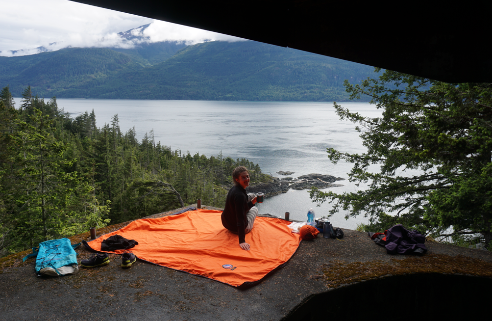
Somewhere on a rare clear day.
But what to do with our 3 weeks of vacation time for our honeymoon?
A good adventurer always has a backup plan in place and we elected to leave north Quadra the day after our wedding, paddle north until we needed to turn around, and then take alternate channels back to our starting spot. This would allow us to connect previous trips from Vancouver to Desolation and from Port Hardy to Bella Coola. It would also make the logistics considerably easier and cheaper and allow us to paddle without violating any COVID restrictions or entering closed waters.
We had a loose itinerary in mind that included traversing all the tidal rapids between the Broughtons and Quadra, paddling the length of Kingcome to see the spectacular pictographs at the head of the inlet; an attempt at Mount Read on Gilford Island; visiting some large trees and as many pictograph and waterfall sites as possible. Aside from that our campsites and daily distances were mostly determined the night before.
Day 1: May 26 – to Francisco Island

The good-bye crew.
We awoke to grey skies and downpours after a late night of skinny dipping in the balmy waters of Hoskin Channel, so motivation to get going was really quite low. We were packed and on the water late in the afternoon and set out to paddle familiar waters to a familiar campsite at Francisco. We didn’t take our usual time to linger in Surge to enjoy the spectacular marine life and instead battled the end of a minor flood current through Canoe Passage and into Okisollo. Photos from this part of the trip are sparce!
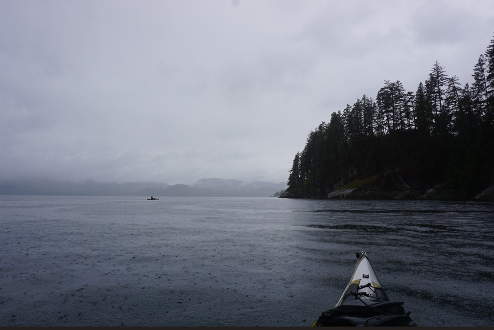
Rain somewhere in Okisollo.
We crossed to Antonio Point on the shoreline of Maurelle, passed the Wood homestead and paddled towards Hole-in-the-Wall. Rain continued into the evening and the usual cetaceans of Okisollo remained hidden. We pulled up to Francisco and unloaded.
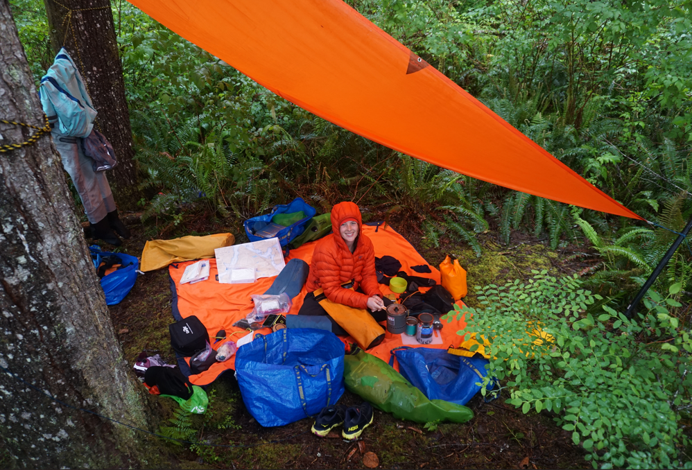
Compared to our mountaineering adventures, sea kayaking allows a level of luxury I still struggle to comprehend. We stripped off wet drysuits for dry clothes, pitched a tent and a tarp, laid out our picnic blanket, set up our double sleeping pad and sleeping bag complete with sheets and pillows before digging into some left over Thomas Haas wedding cake. Rain battered our tarp but we stayed cozy and dry.
Day 2: May 27 – to Howe Island
Another grey uneventful day as we travelled the short distance to Howe Island. We had to time our departure from Francisco to align with the tidal rapids at Okisollo, but even so we arrived early to Howe Island and elected to stay. A wet, cold day with dismal landscape and abundant fish farms had again zapped our motivation.
As John Kimantis notes in his books, north Okisollo is one of the most bland places to paddle on the inside coast – and I must say having paddled most of it I agree. The are no dramatic views, limited options for landing, and fish farms (which will hopefully be changing soon). However, there are several small and charming groups of off-grid homes and cabins along sections of Okisollo between the narrows, and the rapids offer excellent opportunities for marine wildlife viewing. We have also learned that as of December 2021, at least one of the fish farms has been removed (and unfortunately relocated elsewhere on the coast).
We scooted out of Okisollo and turned north along the Sonora shoreline until we reached the shelter of Howe Island. The shoreline turned bluffy and small islands made the paddling more interesting. The weather was quite soft and it seemed like an ideal time to stop.
The clearing at the Howe Island (Sonora) campsite.
This site is not on the BCMT map but I have seen it used before. A small trail leads to a clearing in otherwise thick brush that will support 1-2 tents. Our vacuum sealed chocolate chip cookies did not make it far.
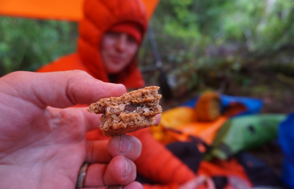
Pro-tip: Vacuum sealing usually turns regular cookies into triple cookies.
Day 3: May 28 – to Tucker Point
Finally we woke to clearing skies and the promise of sun. We were feeling a bit behind with the short days and elected to put in a bigger day to get back on track. We would decide when we reached Loughborough Inlet which direction we wanted to go.

Getting some sun finally.
We knew we had to hustle to make the slack at Green Point Rapids and Cordero Islands; however, our pace slowed a bit as the beauty of the area began to reveal itself. The massive peaks of van der Est and Estero made appearances and the remoteness of the area began to settle in. We bypassed Shoal Bay Marina and instead continued towards the Cordero Islands.
We were sidetracked at Tallac Bay, when checking out if there were camping options, we found a graveyard of chitons, urchins, and other creatures. The high tides seem to have stranded many intertidal creatures. Camping did not look promising.
Tallac Bay intertidal graveyard – red urchins in the hundreds, chitons, sponges, cucumbers and more were washed into the shallow, mucky intertidal zone at Tallac Bay.
By the time we reached Green Point Rapids, the current had built considerably against us, and although we could likely have eddy hopped through the rapids, we elected to explore the islands, look for camping and do some reading in the sun. Even near their max flow, the currents remained fairly mild (few standing waves and no large whirlpools) and looked like they could be easily traversed in the correct direction. We lingered for a few hours before relaunching the kayaks in the early evenings.

We found numerous crimson anemones while exploring around the Cordero Islands.
After paddling past a beautiful collection of homes on the mainland shore, we decided to skip Loughborough in favour of exploring the waters of Port Neville, and crossed back to West Thurlow and began looking for a campsite.

We startled a beautiful cinnamon bear along the shore. The first of many black bears we would see on the trip.
A few BCMTN sites exist in the area, but they all appear to be at old log dumps – not too appealing to be honest. We pulled into a small bay tucked behind Tucker Point. There was evidence of previous use and no signs indicating private property. A sheltered beach with easy gravel landing led to a cleared upland area, where we hung our gear and pitched our tent for the first time without a tarp!
The beach at Tucker Point campsite – easy landing on fine gravel at most tides and a cleared upland. Splendid views down Loughborough Inlet made this a great site.
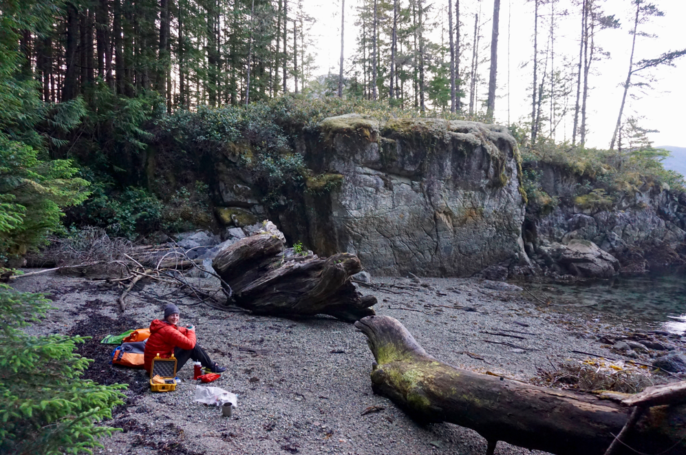
Day 4: May 29 – to Yorke Island
After the late day of paddling the day before, we reluctantly dragged ourselves out of bed to catch slack at Whirlpool Rapids. The shoreline remained varied and interesting, and we enjoyed easy stops near the rapids with large schools of fish swimming below.
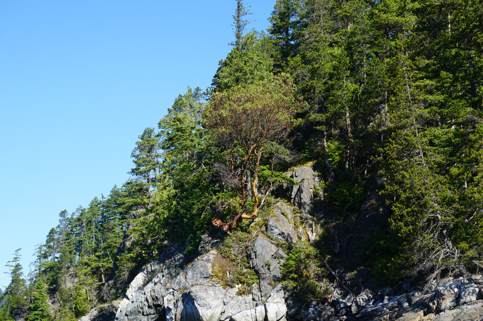
We found an arbutus tree near Whirlpool Rapids, a fair distance out of its supposed range. According to most texts, North Rendezvous Island is the northern extent.
We missed slack by an hour or so but it was flowing in our favour and we rode down the centre of the channel with a slight boost. To be honest though, the eddies and whirlpools negated much advantage in speed and we struggled at some sections to make forward progress. We chose to skip Forward Harbour (regrettably). Some harbour porpoise played in the currents.
We turned and made our way down Sunderland Channel towards Yorke Island in the distance. The shoreline of Hardwicke Island is pocketed with many fine pebble beaches which we took some time to stop at in the sun.

Beautiful pocket beaches are scattered along the Hardwicke Island shore in Sunderland Channel. Camping may be limited, but they make fine day stops, especially after coming from the Discovery area, where fine pebble beaches are few and far between!
We reached Yorke Island in the early afternoon after a thorough exploration of the Hardwicke shoreline. We pulled into the beach on the south side of the island. There is a low angle pebble beach with a trail that gives access to upland camping and connects to the trail and old road system on the island. We met our first other kayakers here – friends of friends from Strathcona Park Lodge out for a few days from Sayward.
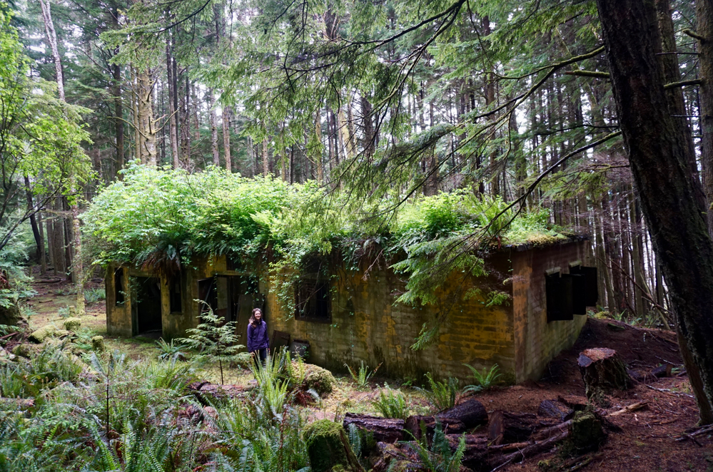
Yorke Island was used during WWII as a defensive outpost by the Canadian military and is covered in old ruins and buildings, and even a few large trees. It is quite fascinating to explore and we elected to take our first rest day the following day. We hiked to the top of the island, but left most of the exploring for the following day.
Our campsite at Yorke Island – there are many options for camping on the island, just beware barbed wire encircles the island. And wait – don’t try to clean it up! It’s an important archeological site and not military trash rusting in the ocean. Duh.
Day 5: May 30 – Rest Day on Yorke

Exploring the ruins at Yorke Island on our first rest day.
We both slept late, but I woke earlier than L, stuffed away some chocolate chip cookies and got up and out of the tent.
I went down to the beach and dove back into my current book: “Island of the Blue Foxes”. A truly epic adventure story. I was so engrossed in the tale of Berring and Steller that I failed to notice Murielle walking up the beach.
He had anchored offshore in his dinghy and we sat and chatted about his kayaking adventures in BC’s coastal fjords. Eventually L woke up and we all shared some fresh fruit courtesy of Murielle. After shooting the breeze for a while, Murielle excused himself, returning with a big smile and a big crab for us. We put it in a pot of water and set it aside for dinner.
Murielle took off back home to Sayward and we went exploring around the island. Thank you Murielle!
Trails criss-cross the island and climb to the top. Buildings and ruin are scattered everywhere and you can spend a bunch of time exploring. Definitely worth the rest day!
Nature reclaiming Yorke Island ruins.
We carried our picnic blanket up to the upper buildings and enjoyed some of BC’s finest offerings: crab, weed, wine, and wilderness.
Dinner with a view. Thanks to friends in Sayward for fresh crab.
Day 6: May 31 – to Johnstone Strait via Port Neville
We left Yorke Island fairly early – well rested from our lazy day. We paddled along the east shore of the island and then crossed directly to Jesse Island. Clearing skies, warm weather, and light winds promised an easy day. We had some sites in Port Neville that we wanted to check out.
We paddled along the beaches of Johnstone Strait towards the entrance of Port Neville and stopped at the old store and post office. Everything is immaculately maintained and I’m sure the place is busy in the summer, with several signs indicating where visitors were welcome and where they were not. We were the only ones there and we explored what we could. What a cool place to raise a family.

The old store and post office at Port Neville. Great history to read about here!
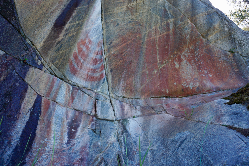
From the post office we continued along the south shore of the inlet, aiming for Collingwood Point. Our reading indicated pictographs and petroglyphs at this location and we wanted to try to find these sites. Unfortunately for us, as we paddled into the inlet, the tide was ebbing and later in the afternoon as an inflow built, the tide would be flooding – sometimes that’s just the way it is!
We disturbed a flock of gulls feeding on a ball of herring, but were still waiting for our first whale of the trip. After a short paddle, we reached Collingwood Point. The local First Nation has done a great job of installing signage for yachters and kayakers that make the journey to visit the rock art.
Despite paddling for nearly an hour in the narrows area and visiting the large midden site at Hanatsa Point, we could not find the pictograph site – frustrated, we decided to continue our search for the petroglyphs (which are often more difficult to find) and landed our boats on the north beach of the narrows at Collingwood Point.
From here we searched 600m of beach and shore searching for the rock art – after 45 min we had found nothing! We had now paddled several hours of unremarkable shoreline and searched for nearly 2 hours to find no rock art. Disappointed, we headed back to the boats. I brushed aside some low hanging cedar branches, and wow!
We had found the magnificent rock art panel at Collingwood Point!

Rock art near Collingwood Point in Port Neville.
After our stop at Collingwood Point, we stripped off the drysuits and continued in the sun towards Robber’s Knob – it was a very hot afternoon. The tide was now flooding and a significant current had built up in the narrows. An inflow wind joined in the fun. By the time we reached the house at Robber’s Knob though, all this had subsided. We searched around briefly before we found the rock art figures in the bedrock along the shore.

Rock art at Robber’s Knob, Port Neville.
We ate a snack of cheese, crackers, and meat, and by the time we left it was early afternoon and we lazily made our way of out the inlet. Paddling along the north shore of Port Neville, we encountered our second and third black bears of the trip! L and I were so fixated on the bear feeding along the shore that it took us a moment to notice the monster lurking behind!

We were so fixated on the healthy, beautiful bear feeding along the shore that we failed to notice the largest black bear either of us have ever seen lurking in the shadows.

Assessing our intent! A massive black bear in Port Neville.
After a great day of exploring, we cruised along Johnstone Strait just north of Port Neville looking for somewhere to camp. Great beaches line the mouth of the inlet, but they are backed by private (albeit empty) homes. We continued a few kilometers to a nice high backed pebble beach with room to store the boats and pitch a tent.

The first of a few “random” JS campsites – great beaches but limited upland. We got lucky a few times (but also had to set a couple of pre-high-tide alarms)!
Day 7: June 01 – to Whitepoint Beach via Port Harvey
Despite the nice weather, favourable tides, and calm wind in Johnstone, we decided to turn north and explore Port Harvey and Chatham Channel, returning via Kingcome, the Broughtons, and Robson Bight, in a counterclockwise loop to Johnstone Strait.
We would very much come to regret this decision.
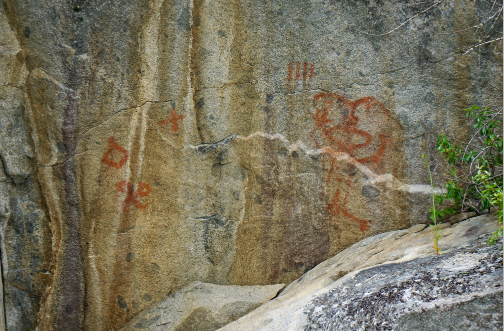
We packed camp, skirted the Broken Islands and crossed into Port Harvey. We were searching for a panel of pictographs that is quite well known on Mist Islets.
The shoreline in Port Harvey is gorgeous, with high bluffs rising from the calm waters. The pictograph panel faces south and is on the main Mist Islet – according to local historians, the stacked canoes may depict a display of wealth or gift giving at a potlatch. Many other images adorn the panel although some are succumbing to the elements.

The stunning panel of pictographs near Port Harvey.
Close-up of the pictograph panel at Port Harvey. Note the stacked canoes.
After spending some time photographing the pictographs in Port Harvey, we paddled along the shore checking out some of the quaint homes and then floated and had some snacks in the boat. We paddled out of the Port, finding a few more scattered pictographs and then crossed through the Bockett Islands to Whitepoint Beach, stopping for water along the way.

Eggs from an unknown species at low tide line near Whitepoint Beach – any suggestions?
It was still early in the afternoon when we reached the beach, but midden beaches are far too beautiful to not spend time enjoying. So we sat in the sun reading and eating and sleeping.
Two other paddlers passed by in the afternoon and we chatted for a bit – they were enroute from Bowen to Blunden Harbour and Port Hardy and we had just missed each other most of the way. Most impressively they navigated Surge, Hole-in-the-Wall, Yuculta, Gillard, and Dent in the same day – nice timing! They continued on to a campsite near Minstrel.

The beautiful beach campsite at Whitebeach Point. There is no upland camping available here.
Our lazy afternoon turned into a lazy evening of more eating and sleeping. For the third night of the trip we didn’t bother to pitch the tarp and enjoyed a gorgeous sunset and our nightly ration of chocolate. Tomorrow we would start heading back into the mountain channels around Gilford Island and Knight Inlet.
Day 8: June 02 – to Kumlah Creek
We left Whitepoint Beach and crossed south of Hull Island to the old First Nations site of Matilpi. A massive midden is a testament to the village that once sat at this ideal site on a creek.
From Matilpi we paddled north up Catham Channel. We had been excited to check this area out as more often than not areas of fast current produce lively intertidal zones, but we were greatly disapointed by Chatham. The channel was a little dull and the shoreline was not particularly striking. Unfortunately our route took us away from the historic site of Minstrel Island, which would have been fun to explore. We later read quite a bit about early settlement in this area in one of the Raincoast Chronicles.
Near the north end of the channel we stopped to photograph another pictograph panel high on a cliff on the mainland shore.
Pictograph panel near the mouth of Knight Inlet.
Our crossing of the mouth of Knight was uneventful and the water was glassy. Clouds clearing off of the larger mountains up Knight was encouraging, as was the forecast for the following day’s attempt on Mount Read, the high point of Gilford Island and one of many features named after William Viner Read on the BC Coast.
With the calm conditions, we took the straightest line possible, crossing Tribune Channel multiple times to reach the shore of Gilford behind Kumlah Island. A few prawn boats kept us company as we searched the shoreline for possible camping. While the First Nations signs on the beach seem to imply the campsite is north of the creek, we found an easier landing and many cleared upland sites south of the creek.

Interesting parasitic fungus on huckleberry bush near camp.
Camping was easily found in the upland and we settled in for another night of great food on the beach. What a great ending to the first part of the trip!
We had finished traversing the “northern rapids” and had entered the mountains of the mainland islands. We were excited for the next week of travel!
If conditions and time allowed, in the next part of the journey, we planned to climb Mount Read, paddle Bond Sound, visit old favourite sites at Watson Cove and Burdwood, and explore Kingcome Inlet – something we had thought too difficult for us on our first kayak trip four years previous. We would return to Johnstone Strait via North Broughton Island and Robson Bight.

We quite enjoyed the beach at Kumlah Creek. The landing was a bit sharp on barnacles, but the upland was clear and the beach was lovely to relax on, however, the beach also appeared to be a collection spot for ghost fishing gear, old growth stumps, and twentieth century logging equipment.
Click here to read part two – Tribune Channel to Johnstone Strait.
