Lindsay and I spent Thanksgiving Long Weekend in the Sockeye Creek drainage just northeast of the popular Tenquille Lake area outside of Pemberton, BC. The access to the alpine is quick and easy via the Hurley River Road and Hope Creek FSR. We parked late in the morning on Saturday in unsettled conditions with the intent of making it to ‘Mystery Lake’ just east of Sockeye Horn.

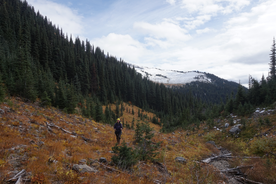
Being one of the few backpacking trips we had done this year and the first dusting of fresh snow made the travel slow – and besides, we were in no hurry. We ascended easily to the forested pass just north of Brown Molar peak and then descended slightly into a rocky draw which intersects the drainage valley of Beaujolais Peak.
Instead of following this broad gully to the intersection of the drainage and pleasant forest travel, we decided the 100m loss in elevation was too much and sidehilled and bushwhacked our way into the valley west of Beaujolais. From here we headed due east through sub alpine meadows and wet bush. We intersected the SW ridge of Beaujolais and crossed it into the Sockeye Creek Drainage. We bashed our way over snow covered scree and small pockets of blueberries and alder.

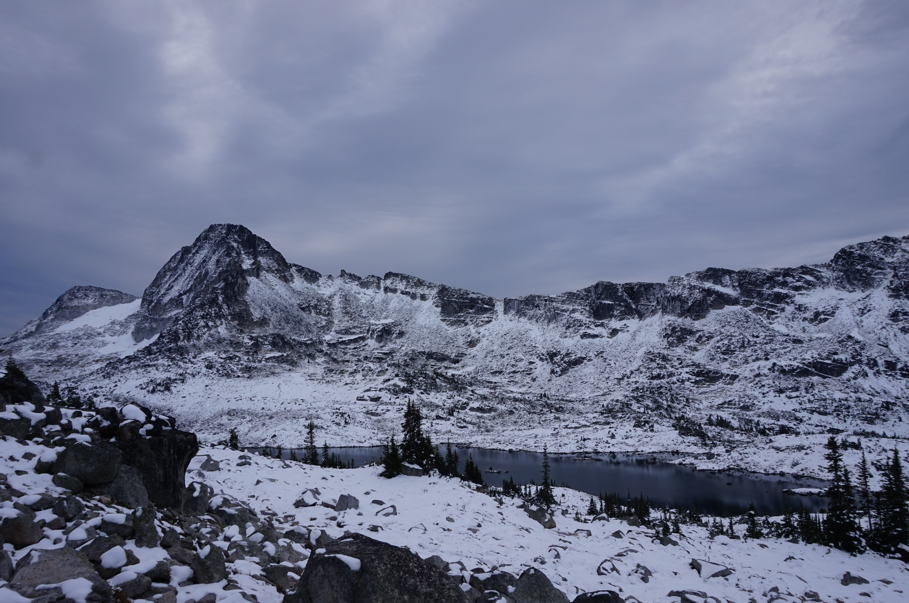
Micro-terrain and snow slowed us down near the lake and by the time we found a flat patch of land to camp on, we had been moving tediously for nearly five hours. Our camp was perched on the edge of Mystery Lake, with Sockeye Horn and our planned ascent route up the SW ridge on the far side of the lake.
Neither Lindsay nor I had ever been to this area before and were quickly inspired to spend some more time here exploring in the future. For now, we set about setting camp, eating, and relaxing in the last sunlight of the day. I remember for some reason feeling particularly unmotivated – perhaps due to not eating well enough during the day. Lindsay as usual, kept the spirits high.

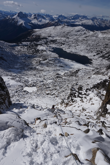
On the second day of the trip we woke up early in no particular hurry. The sun was shining and we only had a short day planned to summit Sockeye and return to our lakeside camp. We headed north around the lake to the boulder-strewn bowl SW of the peak. Travel was extremely slow over slippery, snow-covered boulders. Route-finding in the sun was straightforward and we eventually reached a pitch of steep frozen dirt leading to the SW ridge. We both soloed up this easily, but a slip here would have been disastrous.
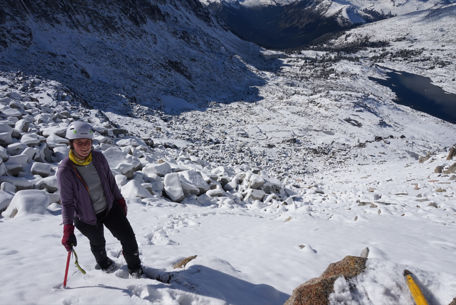
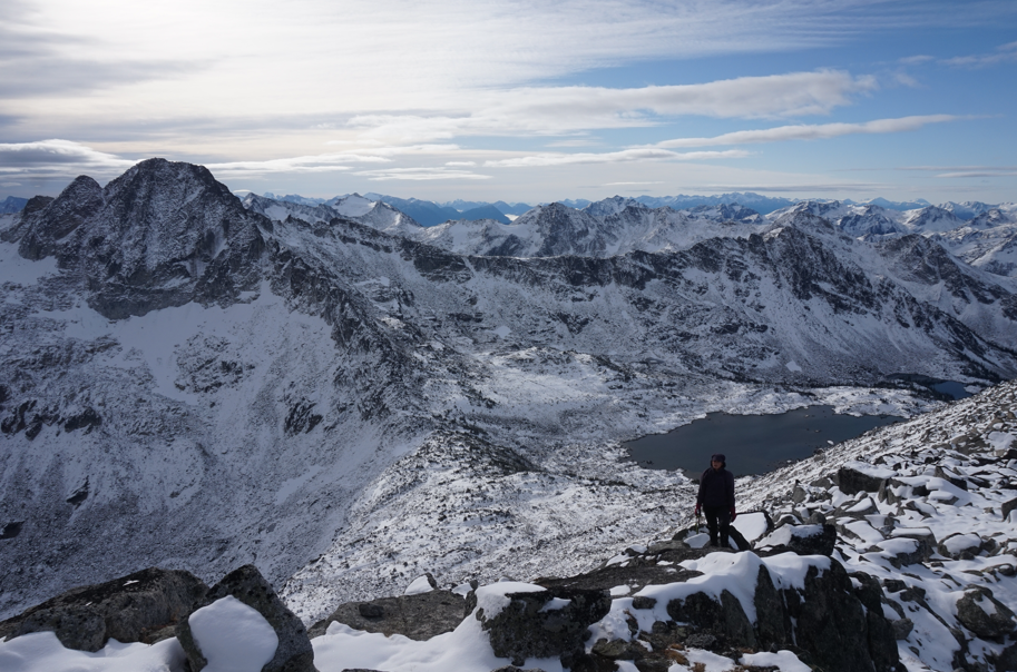
The scrambling on the SW ridge was straightforward with a few fun steps over large boulders and granite slabs. The rock here is granite, but is loose and heavily fractured. We moved slowly up the ridge, enjoying the views to the north to the ‘wine group’ and south to the ‘salmon group’. The alpine lake north of Coho and the glacier on the north side of Snout peak are particularly stunning.
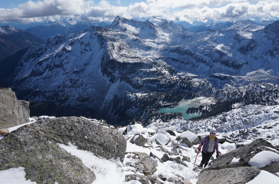
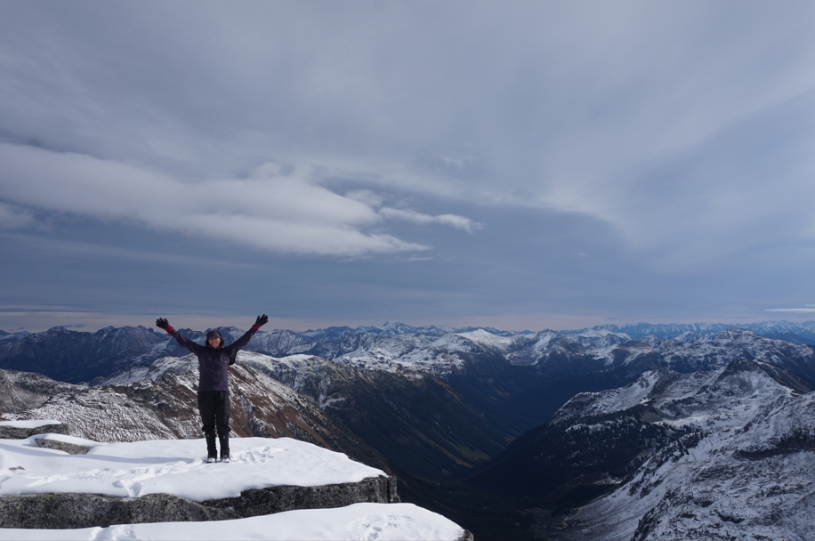
The summit of Sockeye is a large flat-topped boulder offering a perfect place to sit and soak in the views of surrounding peaks. Chipmunk NE face was striking, as were the alpine lakes and ridges stretching north to Verdejo Peak.
We retraced our steps down the SW ridge to the pitch of steep dirt. Here we opted to do some rope-work practice and we built a fast alpine anchor and I lowered Lindsay two pitches down the steep frozen dirt and then down climbed after her. We were back at the lake in decent time and opted to wander around the south side of the lake and back to our campsite. There are many nice flat sandy spots perfect for a swim all around the lake.
Our total time was a bit longer than expected with all the travel being over snow covered terrain. We took about five hours round trip from our lake campsite. Despite the early hour, we both agreed moving the tent wasn’t worth the effort as tomorrow was looking to be a short day ascending the easy SW ridge of Beaujolais Peak behind our camp.

We played Rummy and read at camp, but were soon forced into our double sleeping bag to stay warm. It was a cold weekend and our first night outside in negative temperatures in nearly a year. Needless to say, our toes were nippy.
The next day we woke to high overcast cloud cover with big holes that would continue to clear all day. We packed up in the chilly morning air, disappointed we didn’t have the full strength of the sun to warm us. We headed almost directly up from camp, aiming to intersect Beaujolais’ SW ridge. After some tedious slogging on snow covered boulders, we reached the ridge.

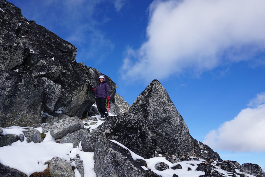
Gorgeous views greeted us in all directions, and jagged skylines spread out from us under increasingly moody skies. We rearranged some gear, dropping the overnight stuff, and continued up the ridge. A very pleasant scramble and ramble with stunning views brought us to the broad, flat summit of Beaujolais. The wind picked up and it was chilly, but we were happy to be in such a stunning area. The Hope Creek drainage is very spectacular.
We retraced our steps down the ridge and reached our gear. From there we dropped off the ridge into the Beaujolais basin, and followed our route out, even making the same mistake of staying too high on the sidehill. On the descent back to the Hope Creek FSR, Lindsay found a large, steamy hole dug into the earth, with fresh bear tracks surrounding – the winter home of a Grizzly. Very cool!
Another fantastic trip with Lindsay!